Description
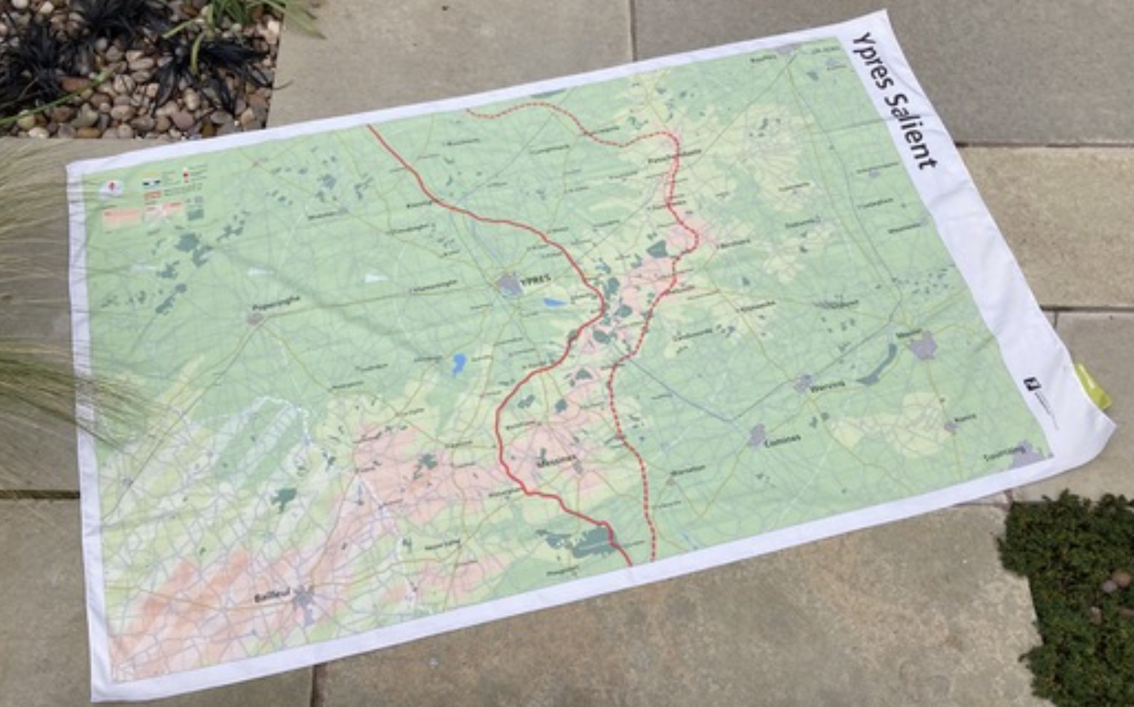
A terrific Ypres Salient Map of WW1 Battles
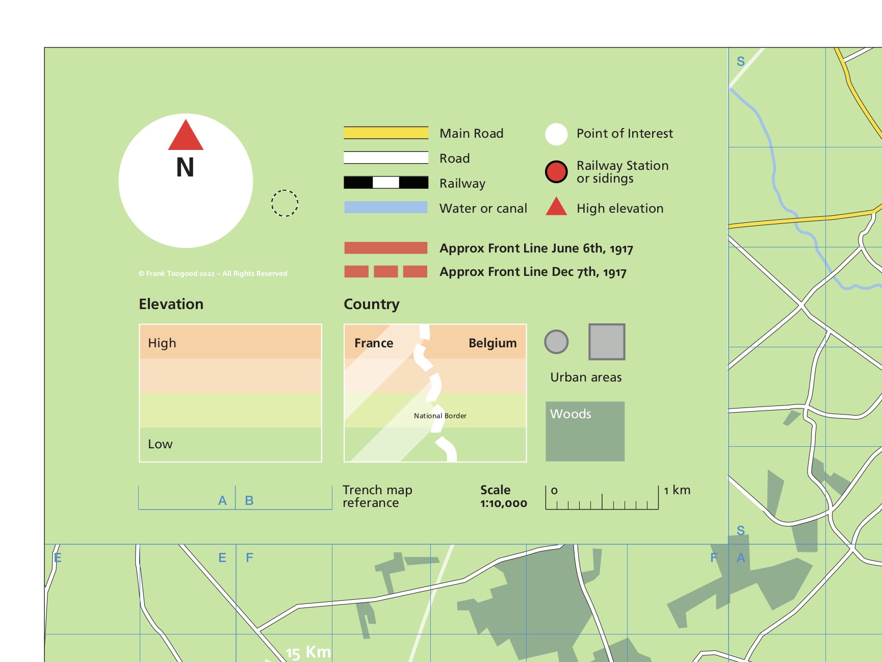
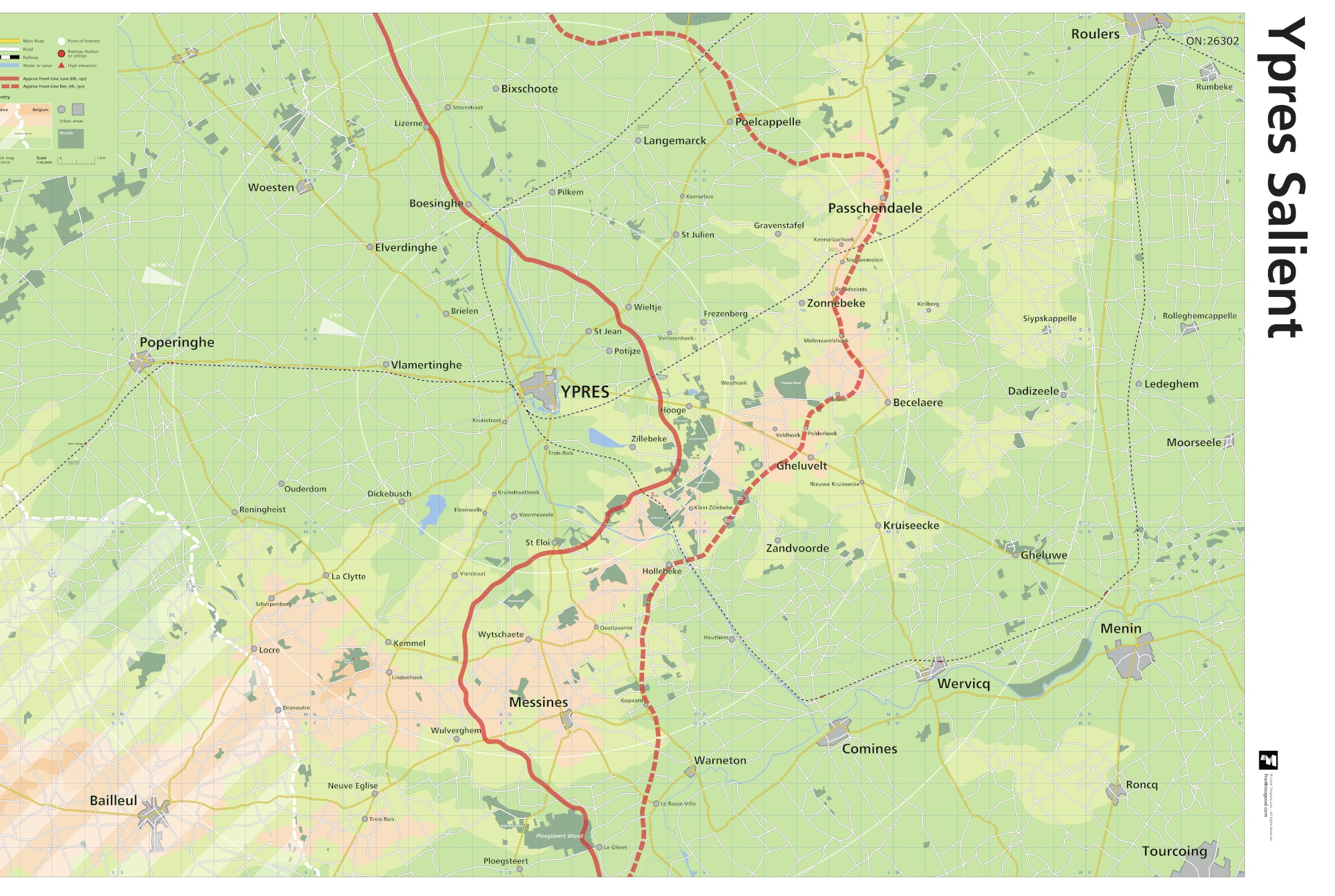
This Ypres Salient map, influenced by the Great War trench maps, is now one of SplashMaps’ History Maps series. Designed to complement trench maps – the grid, grid references (capital letters of the alphabet), road and main railway lines match those of the time, but with a modern look and feel.
Ypres Salient Map of the Front Lines
To highlight the ‘Salient’ and the main areas of battle, two approximate front lines have been added. The first for June 6th, 1917, marking the start of the Battle of Messines and the second, December 7th, 1917, a month after the end of the Third Battle of Ypres, commonly known as Passchendaele.
Ranges of Artillery
3 concentric circles showing 5, 10 and 15 km out from the centre of Ypres, indicate the range of artillery used in battle at that time.
Ideal scene-setting from your Ypres Salient Map
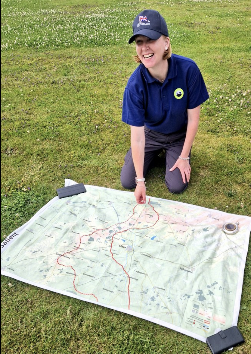
These maps — as found in battlefield history books — are intended as aids for guides to help set the scene during tour presentations. This map is ideal for scene-setting and stand orientation on any battlefield tour of the Ypres Salient.
The Guild of Battlefield Guides
The map was created by Frank Toogood, an Accredited Member of the International Guild of Battlefield Guides, who guides school and military groups for Anglia Tours.
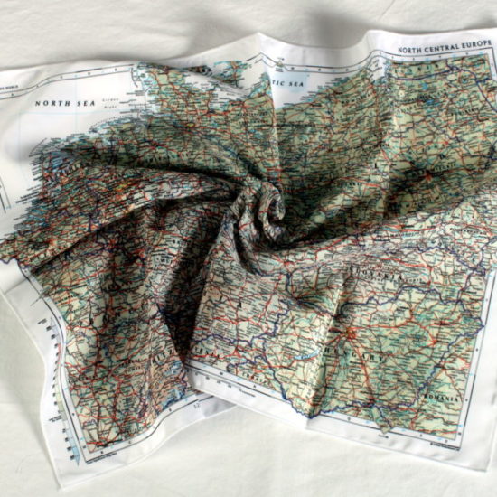
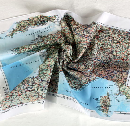
Escape and Evasion Maps
Original Escape and Evasion maps of the period were often printed on fabric to support covert operations and resistance behind enemy lines. Escape and Evasion maps remain crucial in the liberation of airmen and in paving the way for successful campaigns today. Now they find their use in relaying the important facts of the Liberation for future generations.
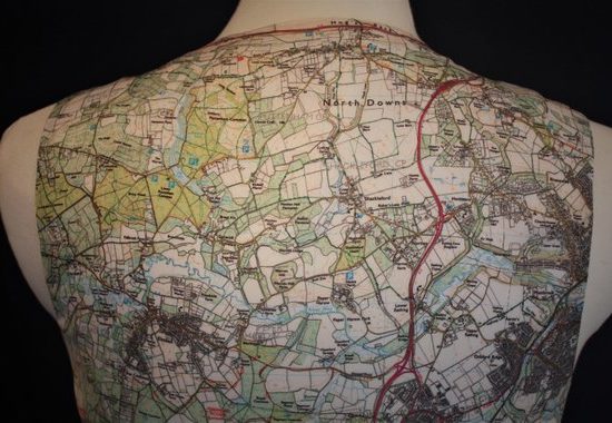
SplashMaps’ Pro weatherproof fabric
SplashMaps’ Pro weatherproof fabric will survive everything. The map will guide you to the key locations and live as a memento of key events from your and the world’s history.
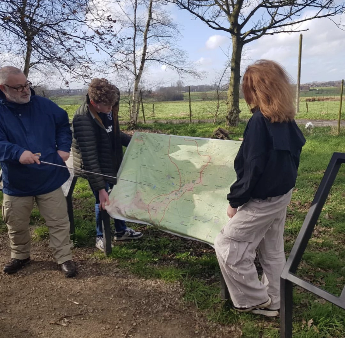
Thanks to Battlefield Guide photographers
Our great thanks to Steve Roberts and Susie Cooper, both brilliant Battlefield guides using SplashMaps in the field. Thanks for taking photos featuring SplashMaps!
Key content
Lizerne, Bixschoote, Boesinghe, Longemarck, Poelcappelle, Roules, Rumbeke, Dadizeele, Ledeghem, Moorseele, Becelaere, Zonnebeke, Frezenberg, Ypres, Poperinghe, Passchendaele, Hooge, Hollebeke, Zandvoorde, Gheluvelt, Menin, Tourcoing, Comines, Messines, Bailleul
Size
140cm x 88cm
Only logged in customers who have purchased this product may leave a review.


Reviews
There are no reviews yet.