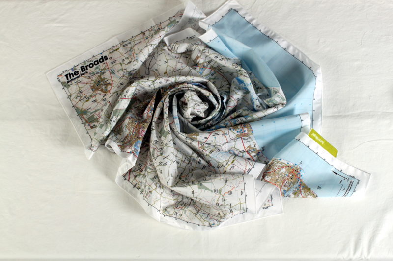

The Norfolk Broads Map from SplashMaps covers the National Park at a scale of 1:50 000. Get yourself from A to B using some of the clearest cartography you’ve ever seen. This SplashMap is printed onto a waterproof fabric. It can be worn as a scarf or stuffed in a pocket. There’s no need to carefully fold. The content of our Norfolk Broads SplashMap includes highlighted bridle ways and by ways. It’s ideally suited for two feet, two wheels or 4 hooves.
Considered making a more specific map for your visit? By Choosing to create a custom OS map of the area you could get your favourite location dead centre in a scale and on a product that works best for you! What could be better?
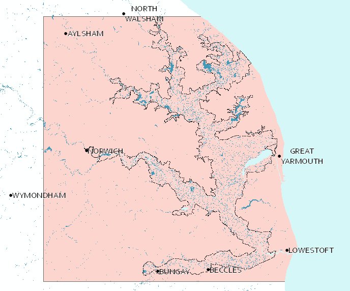
KEY INFORMATION:
Major Settlements:
Great Yarmouth, Lowestoft, Norwich

National Grid Coordinates (Easting, Northing / Grid Reference):
Lower-left – 616244, 288408 / TM162884
Upper-right – 657244, 329408 / TG572294
Scale:
1:50,000
Dimensions on map:
41km x 41km
Size of product (including borders):
73 x 73cm (approximately)
| Weight | 0.06 kg |
|---|---|
| Dimensions | 73 × 73 cm |
Only logged in customers who have purchased this product may leave a review.


Reviews
There are no reviews yet.