
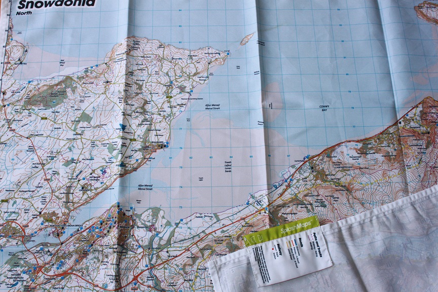

Our dramaic Snowdonia North SplashMap is designed for rugged REAL outdoor adventures! The weatherproof map is printed on fabric and features contours, the OS national grid, walking and riding trails, clearly designated and numbered roads and water bodies. Our signature pub, car park, church and camping symbols make navigating to your start and end points a doddle.
KEY INFORMATION:
Major Features and Settlements:
Conwy, Llandudno, Red Wharf Bay, Beaumaris, Menai Bridge, LLanberis
National Grid Coordinates (Easting, Northing / Grid Reference):
Lower-left – 252000, 358000 / SH520358
Upper-right – 279600, 385200 / SH796852
Scale:
1:40,000
Dimensions on map:
27.6km x 27.6km
Size of product (including borders):
72cm x 72cm (approximately)
| Dimensions | 72 × 72 cm |
|---|---|
| Map Scale | 1:40 000 |
Only logged in customers who have purchased this product may leave a review.


Reviews
There are no reviews yet.