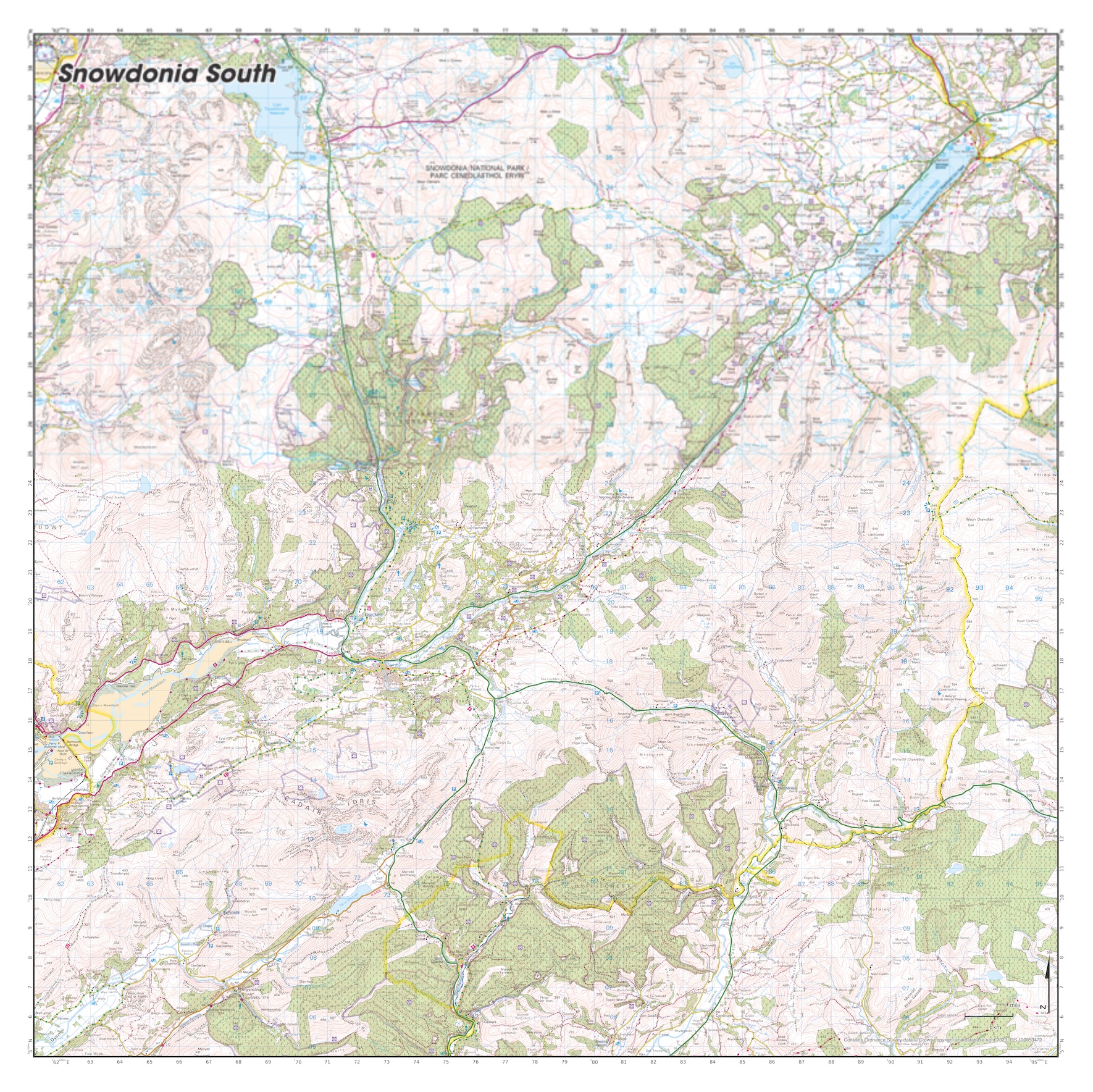
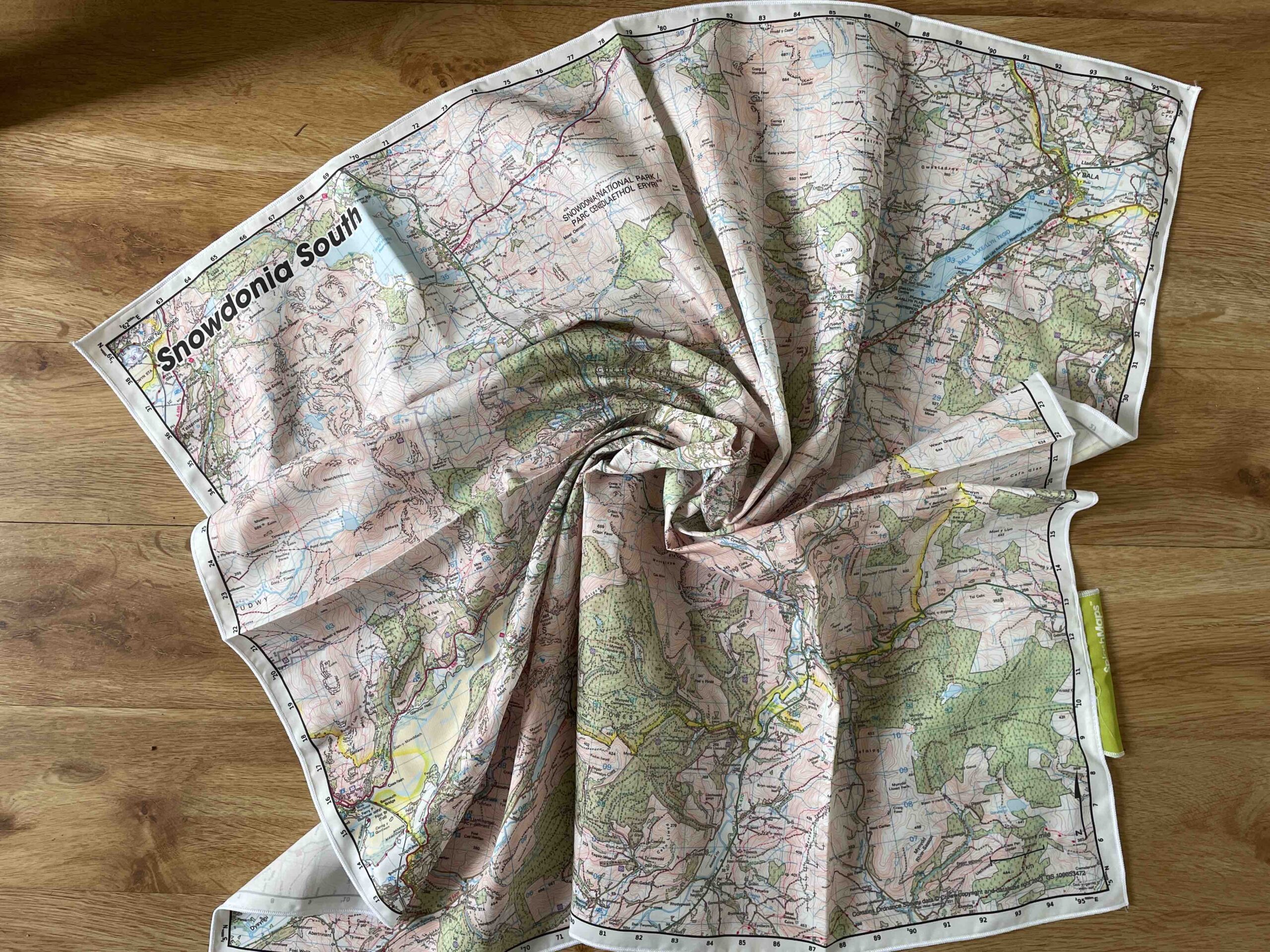

SplashMaps’ weatherproof fabric Snowdonia South Map uses our own REALoutdoor cartography, covers 1130 square kilometres of this dramatic park at 1:50 000 scale. It’s the worlds most practical map designed for any weather because it’s on our performance polyester. This map is positioned to cover the southern section of The Snowdonia National Park itself and is ideal for whichever way you plan to get up there.
Embark on a journey of breathtaking landscapes and exhilarating adventures with one of our Snowdonia Maps, your ultimate guides to exploring the hidden gems of this enchanting destination. Nestled in the heart of Wales, Snowdonia National Park is a haven for outdoor enthusiasts and nature lovers alike.
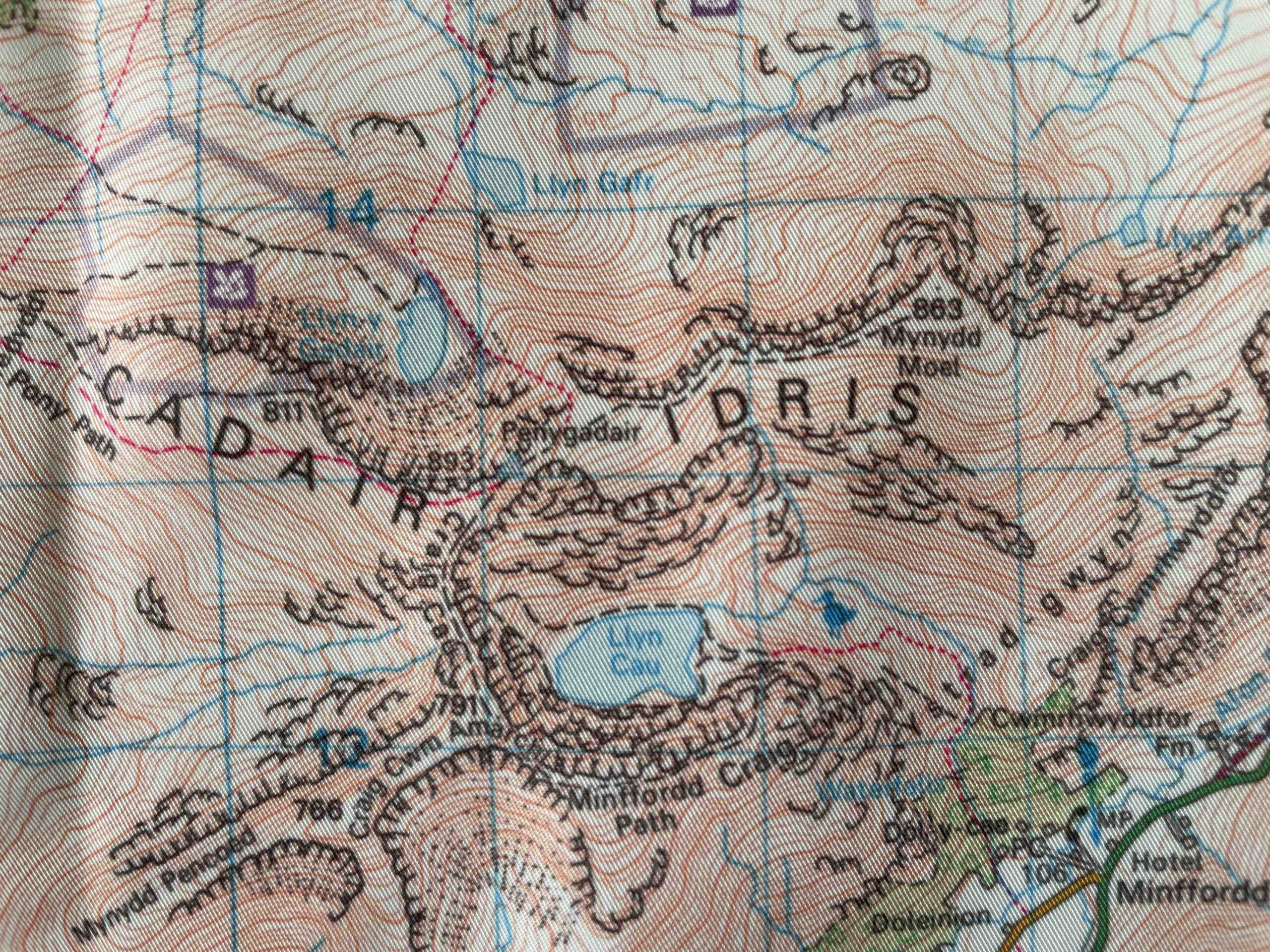
With an abundance of awe-inspiring hiking trails and scenic routes, this map will lead you to the most captivating spots that Snowdonia has to offer. Whether you’re a seasoned hiker seeking a challenge or a casual explorer looking for a leisurely stroll, the Snowdonia South Map has something for everyone. From the towering peaks of Cadair Idris to tranquil lakes like Llyn Tegid and cascading waterfalls, every step you take will unveil a new vista that will leave you in awe.
So grab your boots, pack your map, and get ready to embark on an unforgettable adventure through the unparalleled beauty of Snowdonia. Let the Snowdonia Map be your trusted companion as you discover the best hiking trails and scenic routes that this magnificent destination has to offer.
Why not make a custom OS map of the area to get your favourite location dead centre in a scale and on a product that works best for you?
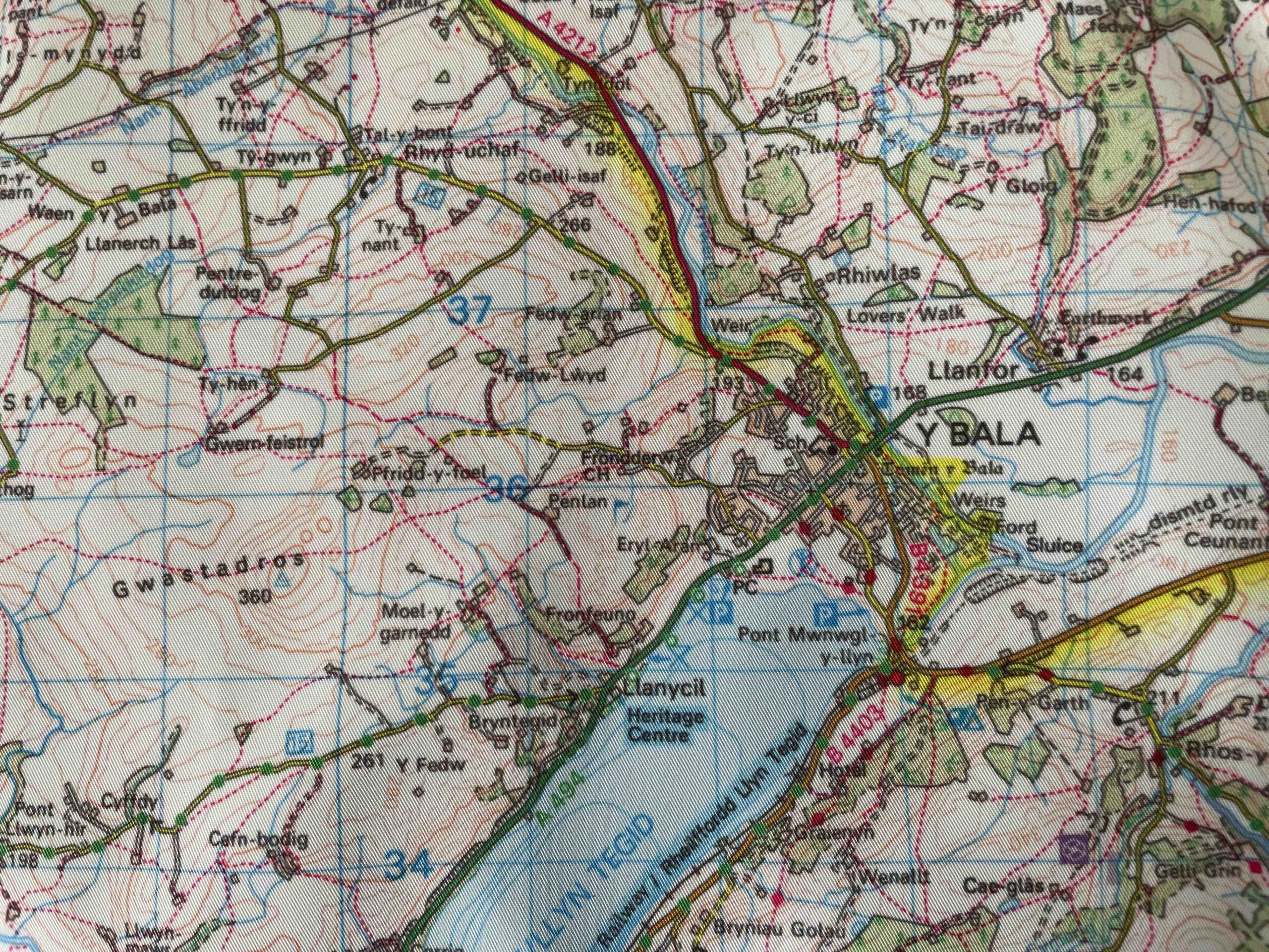
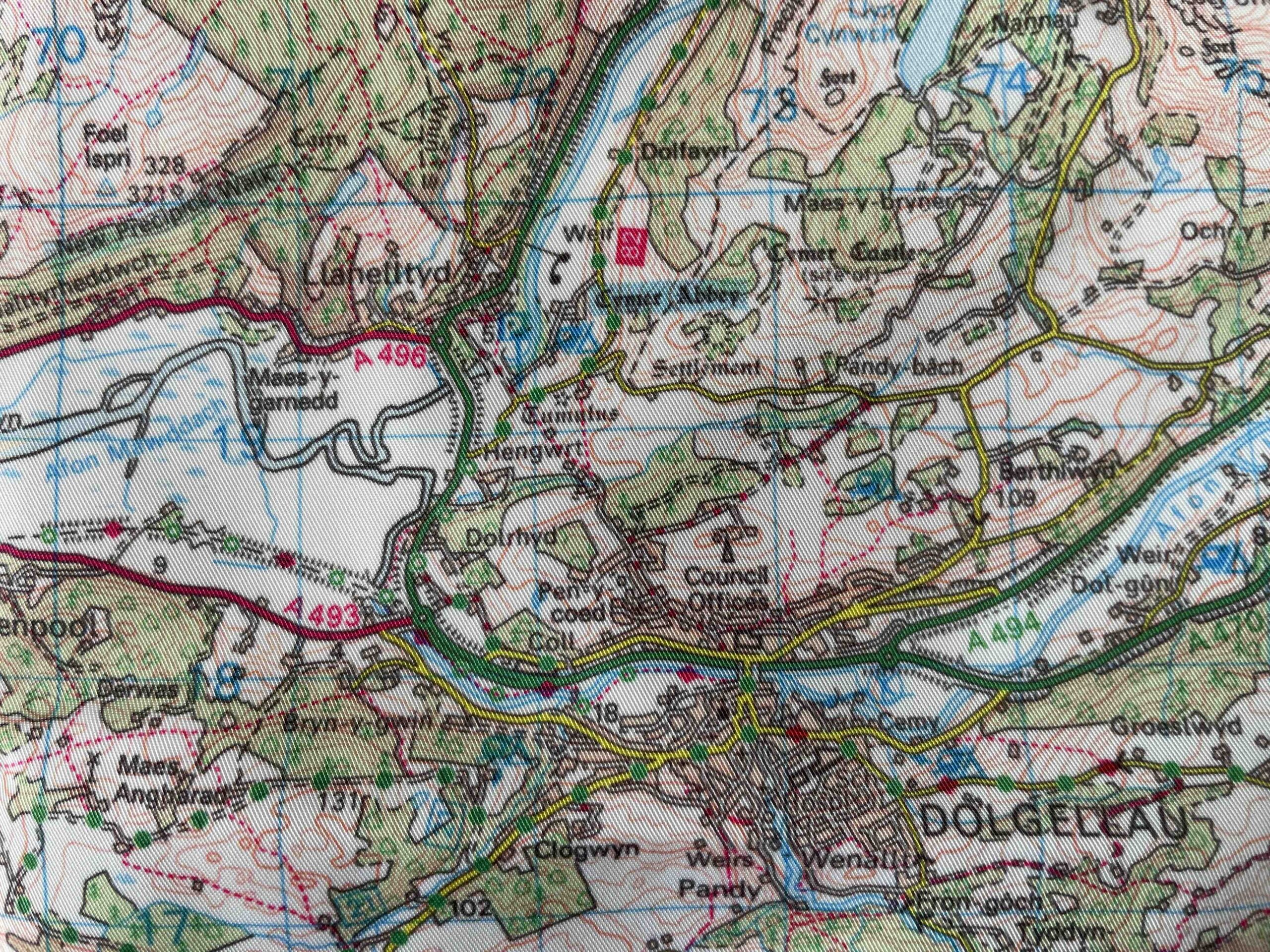
Bala, Barmouth, Coed y Brenin, Llandderfel, Trawsfyfynydd, Fairbourne, Moel feliarth

National Grid Coordinates (Easting, Northing / Grid Reference):
Lower-left – 259000, 310600
Upper-right – 300300, 338300
Scale:
1:40,000
Dimensions on map:
27.6 km x 41.2km
Size of product (including borders):
72cm x 72cm (approximately)
| Map Scale | 1:40 000 |
|---|
Only logged in customers who have purchased this product may leave a review.


Reviews
There are no reviews yet.