Description
D-Day – June 6th 1944, Normandy, France
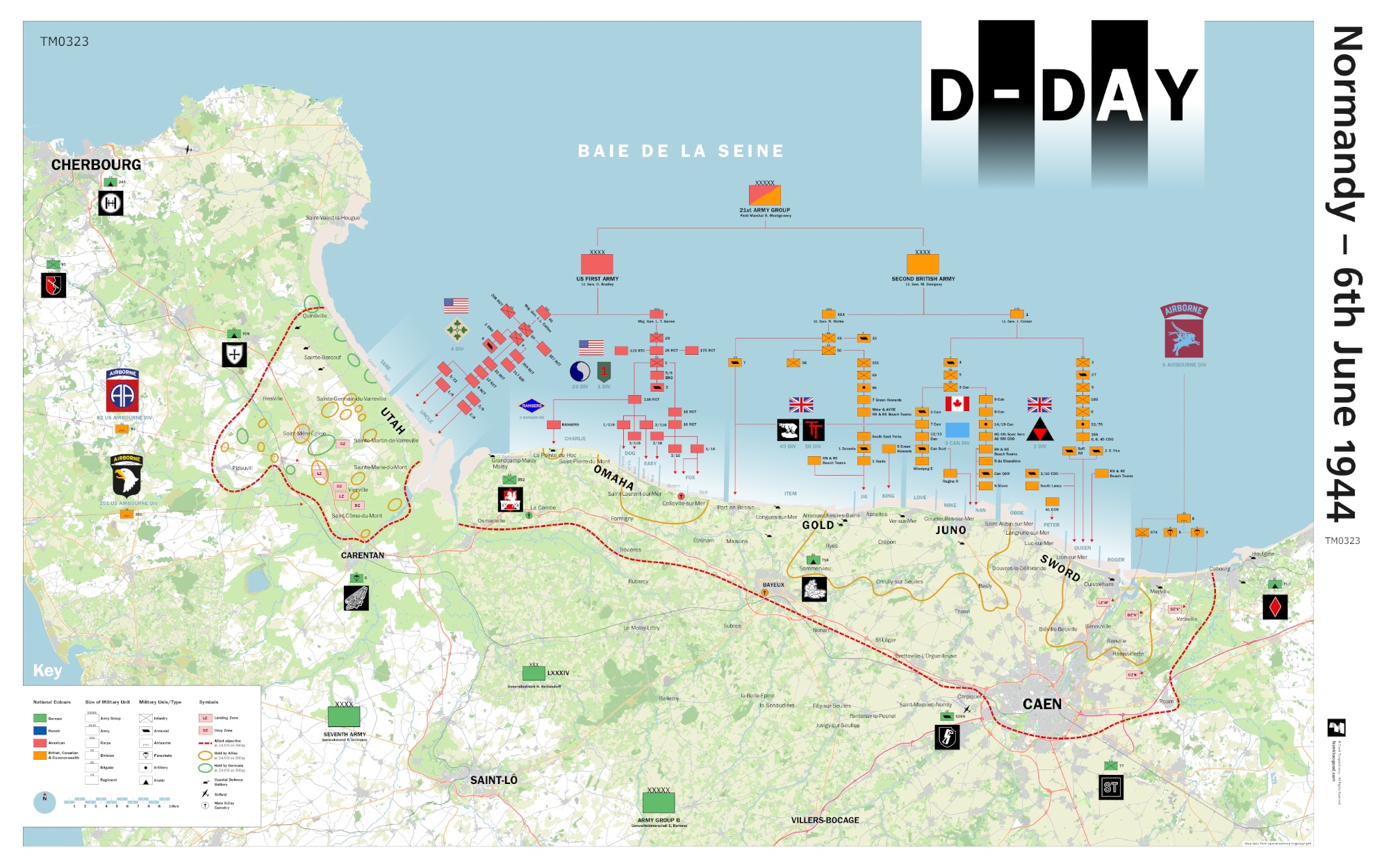
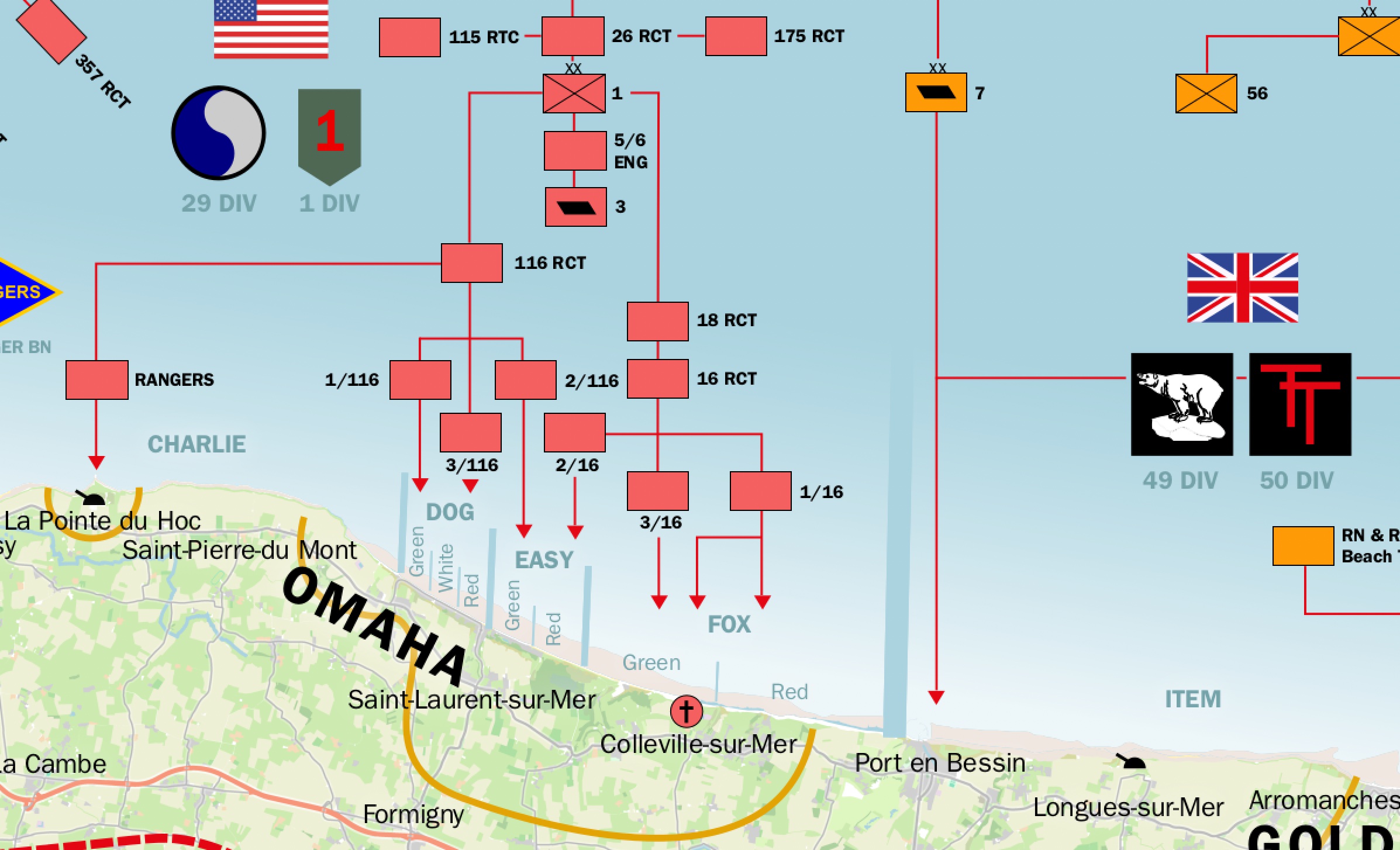
This D-Day Normandy – June 6th 1944 Map depicts the details of troop movements on the first day of France’s WW2 liberation and earns a place in SplashMaps’ History Maps series.
A Normandy Map showing the battlefield as it was on D-Day
The landing locations and the extents of captured land and troop movements are detailed and designed for educating and understanding of this pivotal day.
The Normandy landings, conducted on 6 June 1944, were the seaborne and airborne components of the Allied invasion of Normandy under Operation Overlord during the Second World War. Codenamed Operation Neptune and commonly known as D-Day, it remains the largest seaborne invasion in history. The operation marked the beginning of the liberation of France and Western Europe, laying the groundwork for the Allied victory on the Western Front.
Content
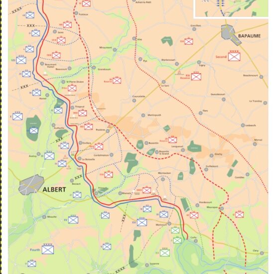
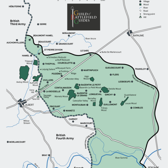
These maps — as found in battlefield history books — are intended as aids for guides to help set the scene during tour presentations. They are an ideal resource for battlefield guiding and other commemorative uses. It illustrates the operations of the British, Canadian, and US forces of the 21st Army Group, including their beach landings and airborne drop zones, alongside the opposing German units of Army Group B on D-Day, June 6. It features the insignia of both Allied and German divisions, Allied objectives, and positions held by 24:00 on D-Day. Major coastal defence batteries and military cemeteries are also shown.
Ideal context setting
Designed as a historical companion for visits to the Normandy D-Day beaches and airborne drop zones.
The Guild of Battlefield Guides
The map was created by Frank Toogood, an Accredited Member of the International Guild of Battlefield Guides, who guides school and military groups for Anglia Tours.
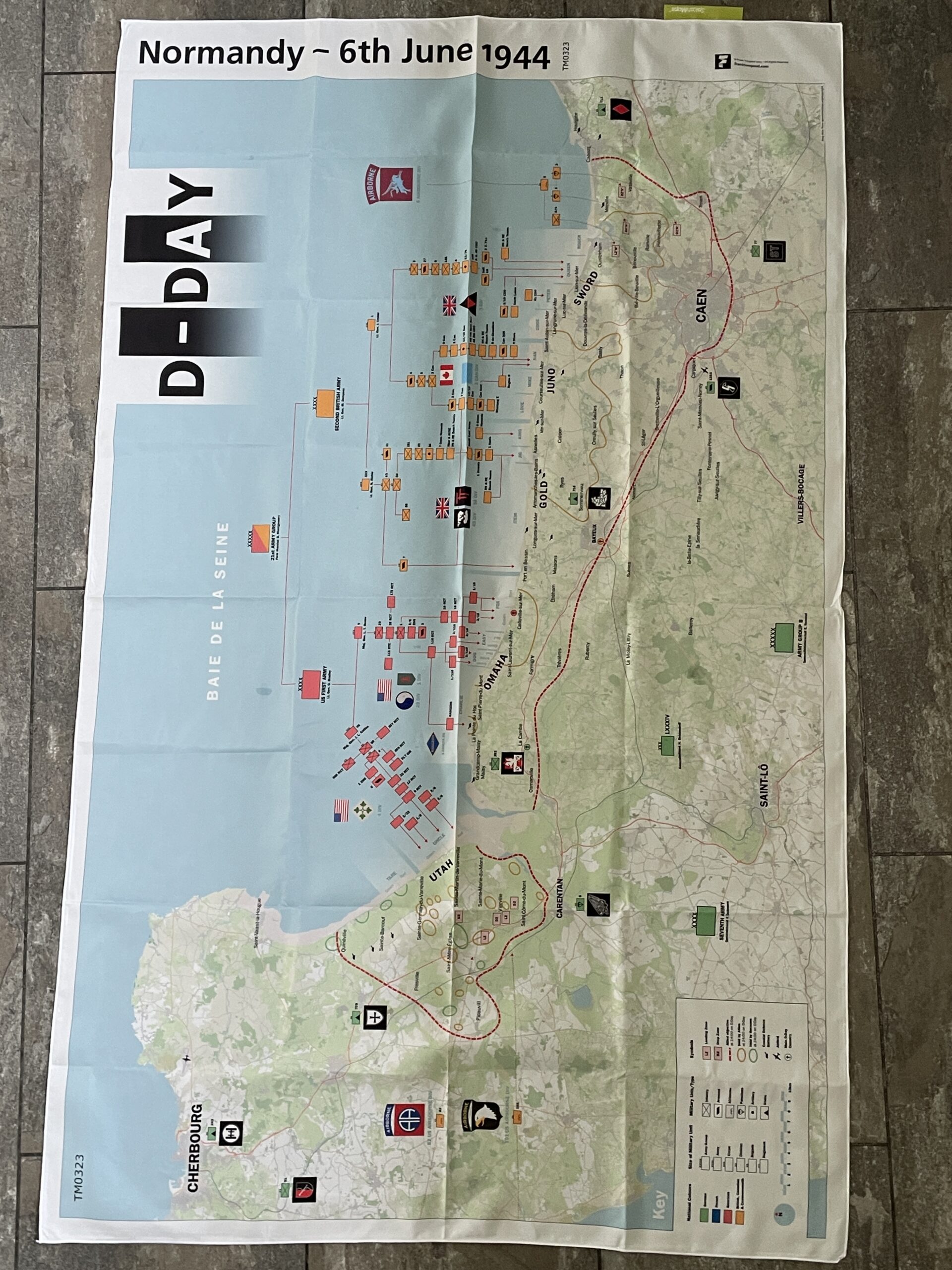
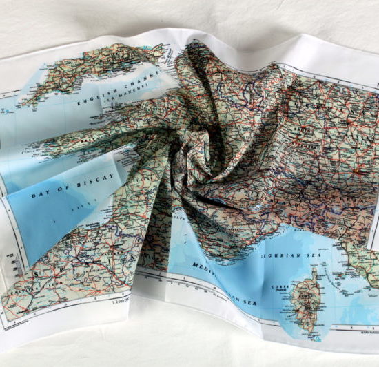
SplashMaps’ Pro weatherproof fabric
SplashMaps’ Pro weatherproof fabric will survive everything.
Key content
Normandy, Sword, Gold, Omaha, Utah, Cherbourg, Caen, St Lo,
Size
88cm x 140cm
Only logged in customers who have purchased this product may leave a review.


Reviews
There are no reviews yet.