SplashMaps is well established now and it’s time to share one of our most productive trade secrets. We haven’t been paying our data licenses!
Shock horror? For most map businesses such a confession would lead to outrage, possibly some legal shenanigans and probably a large fine. I’d be out of a job.
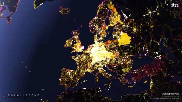
Rightly so? After all SplashMaps has been making desirable and successfully commercial products based upon the best mapping data available. But in fact the best mapping available is actually provided under open license. The consequence? We don’t get to pay those lovely licenses, but instead use our skills to fuse together the most appropriate data from numerous reliable sources to create a unique map in our own style. The only obligation on us is to credit the sources. So thank you to all the Local Authorities, the Ordnance Survey, the Forestry Commission and, most importantly, to all the contributors to OpenStreetMap.
We, and a growing number of companies such as TelNav, are increasingly reliant upon volunteer maps from OpenStreetMap. The system had been likened to the Wikipedia of maps in that it uses a crowd of volunteers to keep the information up to date and extensive.
The great thing about a business that benefits from this increasingly reliable system is that you feel compelled to contribute yourself, often using your network of customers like remote sensors of their well known environment.
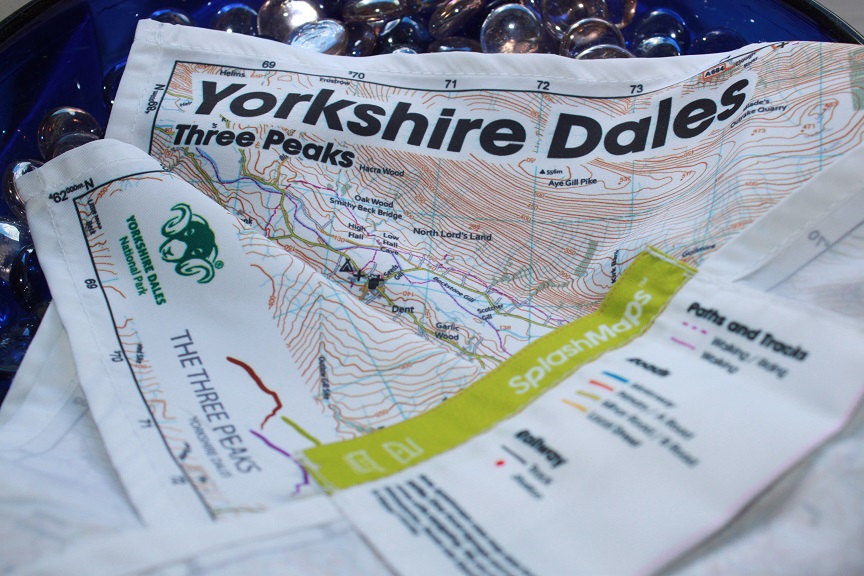
Recently our customer at the Pen-y-Ghent Cafe in the Yorkshire Dales identified anomalies in our mapping and carefully talked us through what was wrong. There were a number of items;
1) A Car Park appeared where there was no car park
2) A beloved pub was missing from the map
3) A well used campsite had not featured on the map, and
4) There was a memorial hall marked on the map where no such place existed
5) A train station was not marked, though its name was on the map.
With a solid description from the customer of exactly where these unusual errors were we were able to use our sources to verify and then the simple Potlach editor at www.osm.org to correct, where necessary.
1) clearly someone had been carefully coding in a nice stone wall enclosure and had accidentally designated as a car park. This looked like a bit of fun by someone, and it took a few seconds to fix.
2) the pub was actually quite famous. I imagine someone had taken it out of the data to keep it out of the limelight. Sorry guys! It’s back now.
3) the camp site was a fairly modern Caravan and Campsite. We’ve now coded it into OSM data so it’s available for all.
4) Someone had already deleted the memorial hall out. It’s not often these unusual comedy buildings turn up in OSM, becuase when they do a local OSMer will often spot it and correct it within a few days. We were unlucky with our timing on picking this one up in our print.
5) Our love of frothy beer got in the way of this one! We based our spec on mountain bikers. This meant we prioritised pubs above most things. The station was there (the name was there, so it’s clear to the user there was a station), but the little red dot was not. It was skulking behind our frothy pub symbol. Easily fixed!
Our next update prioritises stations above pubs and is already on sale in the Pen-y-Ghent cafe and here!
Ah! Just took a phone call from a potential retailer in the West Peak district. Anyone want to help re-assign rights of way designations to the path detail there? The building goes on!
