Mind the Gap! Fabric Maps Fill In Detail Left Out In TfL’s Latest Tube Map
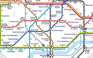
Want to walk between tube journeys but not sure of the best routes? A new series of London fabric maps could be the answer, picking up where Transport for London’s latest tube maps (showing walking times between stations) leaves off.
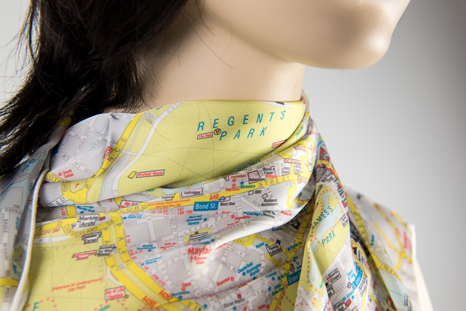
These London street maps are printed on breathable satin so they’re wearable, or can be scrunched in a bag or pocket. They come in three versions; the cabbies favourite, A to Z, familiar Ordnance Survey, or historical 19 century illustrated *. Easy to read, washable and very attractive to wear, they don’t need folding or any potentially unreliable tech, SplashMaps could now be the best way to find your way around London.

“Walking’s the ideal choice for commuters and visitors to our beautiful capital” says David Overton, founder of award-winning sports mapping brand SplashMaps. “It’s free, it’s great exercise and just think what you miss in life by keeping your head underground! Often we’re in a hurry and assume the tube will get us there quicker or more reliably, but sometimes walking is much more direct. The new TfL tube map recognises this by showing how long it would take to walk between stops. But it doesn’t give you the detail you need once you’re on foot, and that’s where SplashMaps excel; because they’re simple, and designed to help anyone step out confidently.”
Fabric maps were used for escape and evasion during the war. These days as well as helping out with the London commute they give walkers, cyclists, and runners from all regions confidence in their adventures. You can select locations anywhere in the world to create a highly personalised SplashMap online, which is then printed onto our virtually indestructible fabric. SplashMaps also has a number of UK based military customers, makes bespoke SplashMaps for cub and scout groups and adventurers and explorers world-wide.
The full range of London maps (at £20-25 each) are available direct from www.splash-maps.com. Destination SplashMaps, including all Britain’s National Parks and long distance trails for all major off-road routes in the UK, are also available from the website at prices from £18.99 to £42.00 or in a number of retailers including Stanfords Travel, GIANT St Pauls Pauls and Look Mum No Hands in London. Anyone wishing to support SplashMaps can also follow on twitter.com/SplashMaps or like on facebook.com/SplashMaps.
Ends
CONTACT: David Overton, MD, SplashMaps Ltd,
*designed by specialist cartographer Mike Hall
Full Media Release: 20151113-SplashMaps- London Release FINAL
