The use of SplashMaps in Disaster response is on the increase! The latest business to put our virtually indestructible fabric maps to the test was the International Disaster Response of Germany, or “@fire” as they are known.
This non-profit NGO has had recent deployments for wild-land fire fighting, urban search and rescue and humanitarian aid to Thailand, Haiti, Philippines, Greece and Nepal.
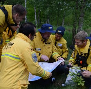
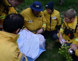
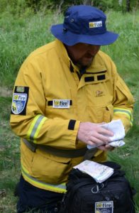
“We recently held a survival weekend as part of our training during which I demonstrated a range of SplashMaps” says Anthony Chomley, Chief of Safety. We’d noticed a number of our maps being designed for remote locations and being delivered to Anthony’s address in Germany, so I gave him a call.
“SplashMaps are a fantastic, essential piece of gear…” he told me. “I have my role in @fire and am a H.E.A.T. instructor for the government” he explained, “A lot of interest has been seen from both groups and the possibility of <bespoke> escape and evasion maps is another great opportunity,” he added.
@fire is the latest of the long list of businesses relying upon SplashMaps in disaster response situations. Check how the Scientific Exploration Society, The World Bank, Prepare and Survival Wisdom use SplashMaps to save and improve lives around the world.