Description
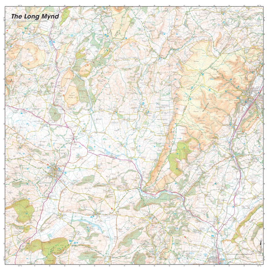
Long Mynd
Could this Long Mynd be the most dramatic and challenging part of the Shropshire Hills? The heath and moorland plateau is a must-visit if walking, riding and areas of Outstanding Natural Beauty are your things. Much of the area is owned and managed by the National Trust and it is crisscrossed with ancient trails where the Roman roads took advantage of the pre-existing Watling Street.
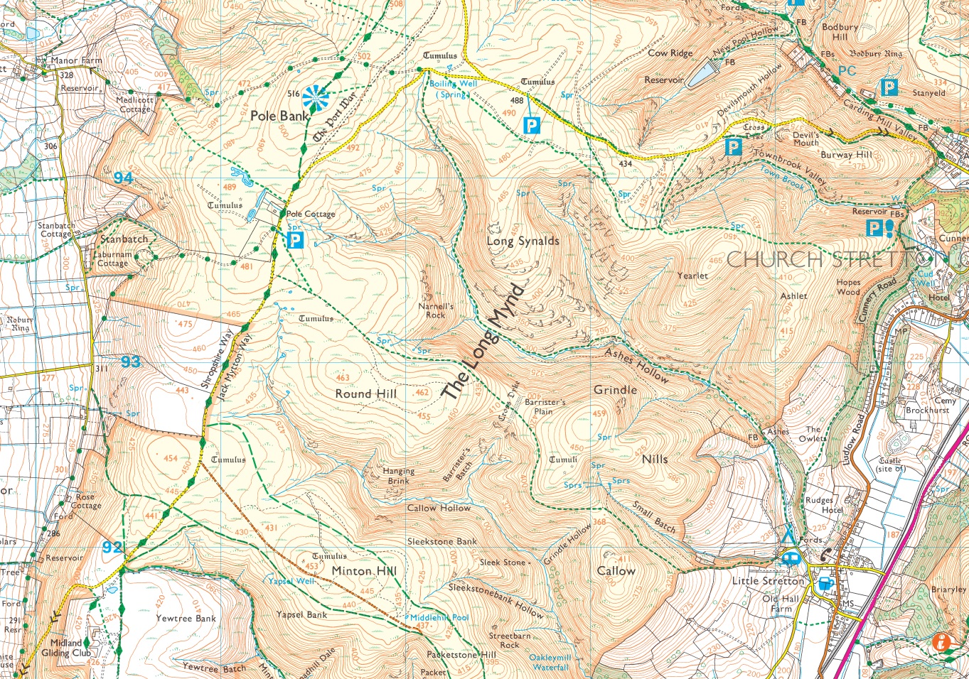
Trails
Shropshire Way, Jack Mytton Way, Motts road, The Port Way, Watling Street
Features and places
Michell’s Fold Stone Circle, Priest Weston, White Grit, Lan Fawr, Corndon Hill, Black Radley Hill, Roundton Hill Nature Reserve, Bishop’s Castle, Bryn Hill, Sunny hill, Steppleknoll, Clunton Hill, Lydbury North, Totterton, Norbury, Myndtown, Wentnor, Linley Hill, Stiperstones, Stiperstones Nature Reserve, Ratlinghope, Woolstaston, Church Stretton, Pole Bank, Little Stretton, Minton Hill, Ridgeway Hill, Alcaston, Hopesay Hill, Craven Arms, Lower Dinchope, Long Mynd
Scale & Style
1:25 000 Ordnance Survey Explorer style
Location Coordinates
Lower Left: 329 000, 282 500
Top Right: 346 500, 299 800
Only logged in customers who have purchased this product may leave a review.


Reviews
There are no reviews yet.