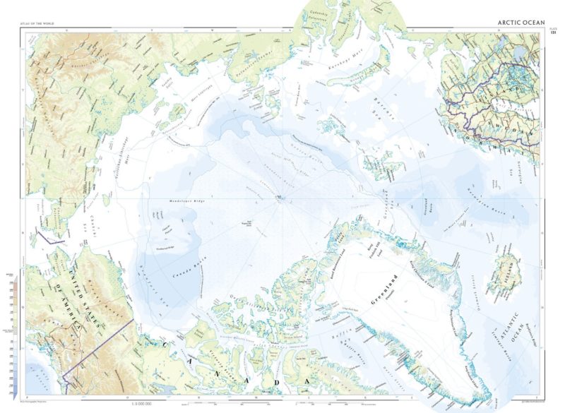


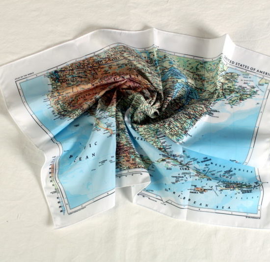
The Collins Bartholomew – Arctic Circle Map covers all countries and seas within the Arctic Circle. Printed onto our Pro breathable, washable and very wearable fabric, it is designed to be usable in the harshest conditions and can be stuffed in a rucksack. You may even want to admire its beauty at home or wear it as a scarf.
This map is designed by legendary cartographers, Collins Bartholomew.
This is a physical map and comes straight from the Times Atlas Plate 131.
KEY INFORMATION:
Major Continents:
Greenland, Iceland, Norway, Sweden, Finland, Russia, Alaska and Canada. It highlights the seas (Norwegian SEa, Greenland Sea, Barents Sea, Karskoye More, Vostochno-Sibirskoye More, Chuckhi Sea, Beaufort Sea, Baffin Basin. It features the record low ice extents and the average summer extent of ice.
Scale:
1:11 000 000
Size of product (including borders):
72 x 54cm
| Dimensions | 72 × 54 cm |
|---|---|
| Map Scale | 1:11 000 000 |
Only logged in customers who have purchased this product may leave a review.


Reviews
There are no reviews yet.