geomob London celebrated all things circular last Tuesday night. From circular walks to circular tube maps to re-cycling speakers!
The SplashMaps Catch-up
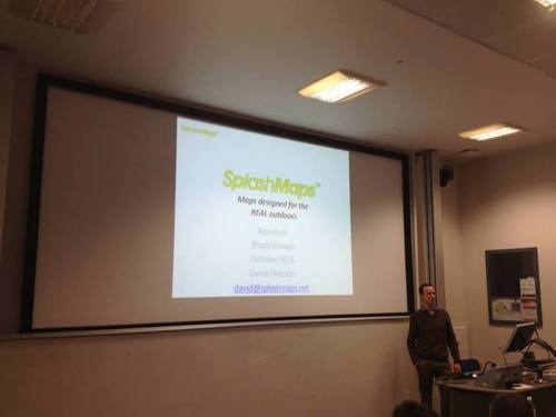
I had the honour of being the only presenter in the history of Geomob invited to give an update presentation! Ed Freyfogle (who runs the show) told me there’s such interested in the next location technology event on January 14th that all speakers are already booked! So I was really pleased to asked to talk again at this popular and thought-leading event.
I ran through our progress to date (read previous blogs, and please read my slide-set). I shared our gratitude to geomob with the audience; so many of them had backed us in the early days, so many had bought maps since and, in general, our association with geomob continues to lift us from success to success.
It was a great opportunity to;
Details of this session are here https://geomobldn.org/, and a couple of the talks I found most pertinent to us now are shared with you below;
Circular walks
Dimi Sztanko has been working for some time on his project Walks.io; a great little app that uses 15 different data sources to determine a “nice” circular walk starting at any train station in England. He’s now teamed up with user insight and design expert, Patu, who will help him design the apps in the most engaging way.
I’ve just tested it out on my local station (try yours!), Chandlers Ford and was amazed that the automatically generated route took paths I know and really did take in probably the best of the routes available for a 1.5 hour stroll!
The technology prioritises geographic features in terms of what (in Dimi’s view) would make for a nice walk. So water features appear high up the list as do listed buildings. Main roads sit at the bottom.
Starting with train stations is a terrific idea. Stuck with time on your hands at a station? Here’s a great way to use that time.
Dimi later told me that his technology can take any start point, so stations are just the start. Car parks, hotels and other tourism destinations could all feature. Perhaps even my own house!
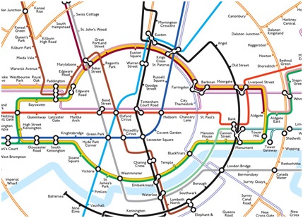
Circular tube maps
Max Roberts from Essex University shared his latest map design with us. Breaking with the Henry Beck tradition for network maps (all about consistent angles, straight lines and coherence), Max instead has gone for a style based on circles, tangents and bisections. The result has gone viral and the success with the London underground has led to circular maps in all our favourite capitals. See picture below.
His lecture brought home the importance of coherence and clarity. Max seems to achieve both by following a fixed set of rules and logic with a beautiful and intriguing result.
