Fabric maps are an innovative way to explore the world and discover new places. They are lightweight, waterproof, easy to fold up, and incredibly durable.
It’s no wonder that fabric maps are being viewed as the best maps among hikers rather than alternative paper maps or a GPS!
In this blog post we will discuss why fabric maps can be better than paper or digital for walking and hiking wherever your path takes you.
We’re lucky in many ways – first that we have access to the great outdoors, and second that we can use wonderful Ordnance Survey Maps and Harvey Maps when we venture out on our adventures. OS maps are, of course, the gold standard for UK mapping.
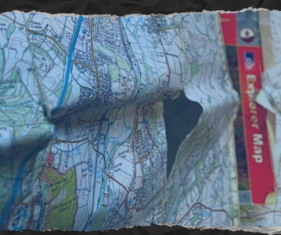
The saying goes that there’s no such thing as bad weather, only bad clothes, and the same can be said for maps. In wet and windy conditions a “traditional” map is reduced to scraps of useless, soggy paper in no time at all. And in bright sun you’ll struggle to see the screen on your phone or GPS.
So what is the alternative?
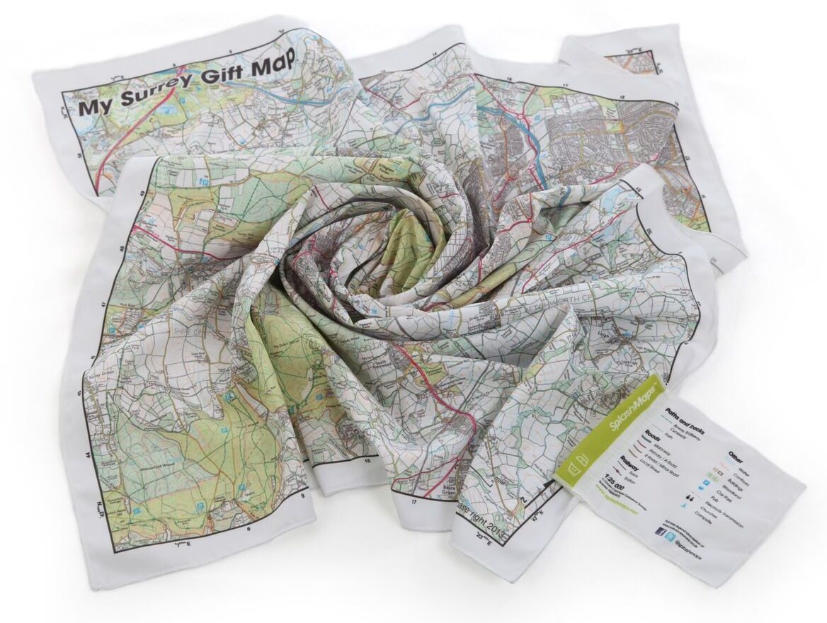
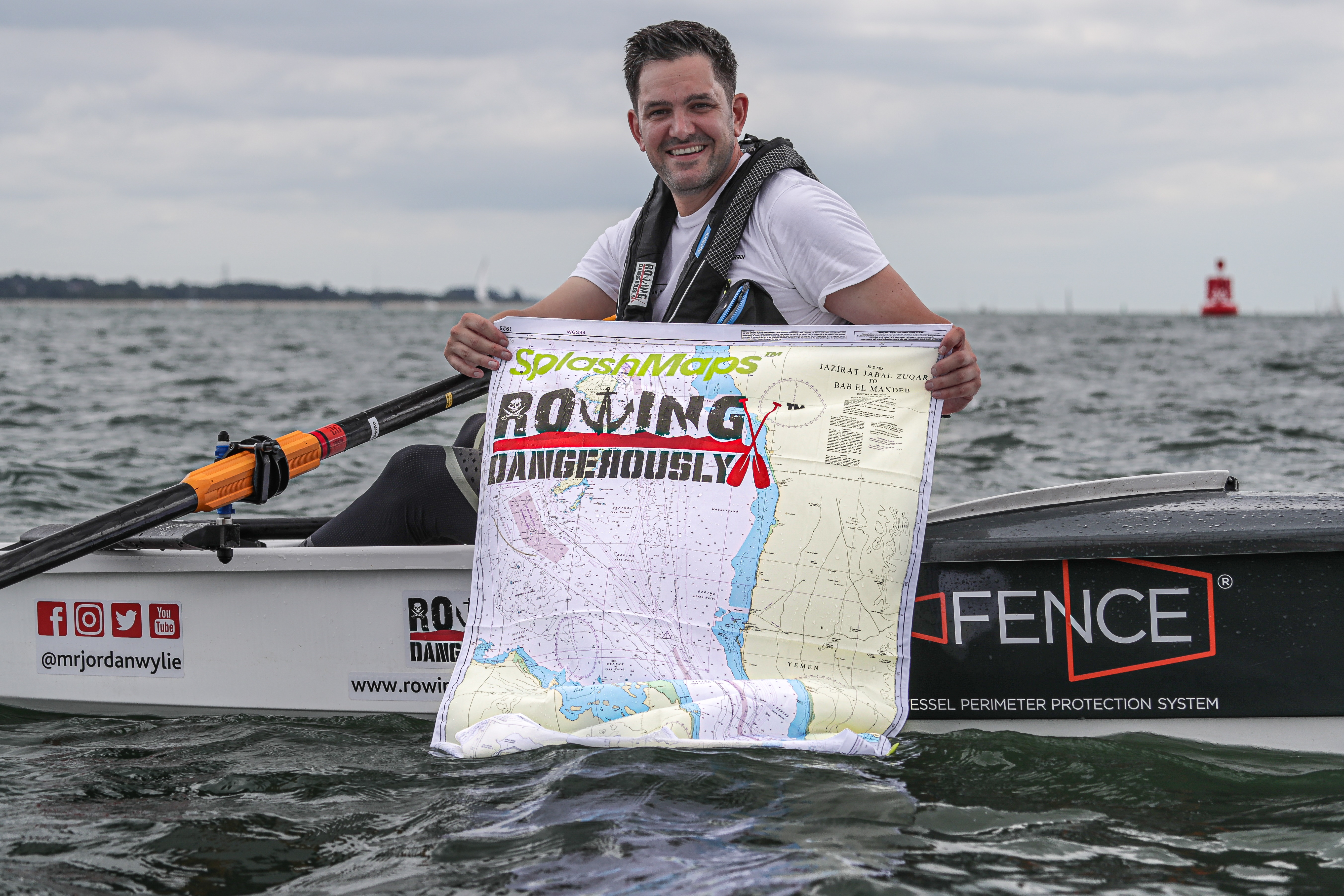
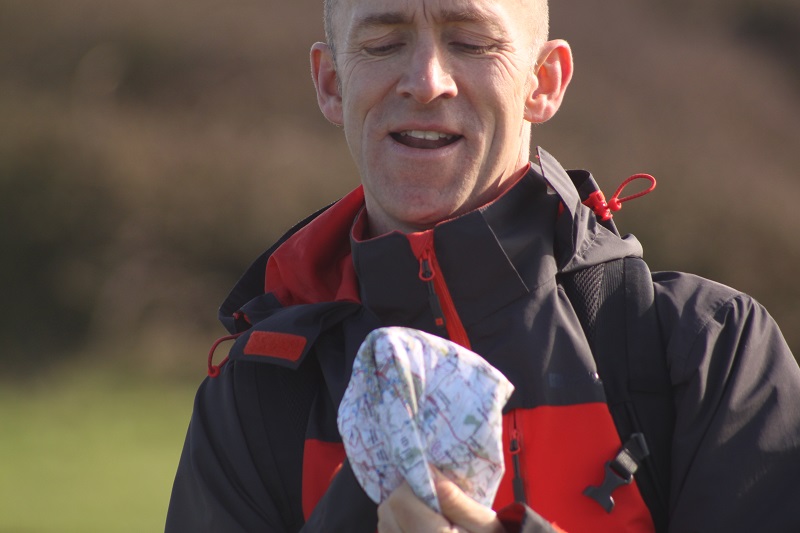
Fabric maps! They’re the analogue alternative and come in a range of scales and sizes, they’re lightweight, durable and waterproof – the best maps in all weather.
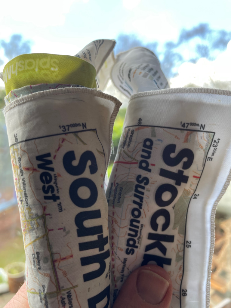
Fabric maps can be easily rolled up tight to fit into your pocket or backpack so you always have them with you when you need them most.
A map like this could be used to plan routes for hiking and walking in the countryside, or it might show the distance from one place to another – perfect if you’ve got an endurance event coming up!
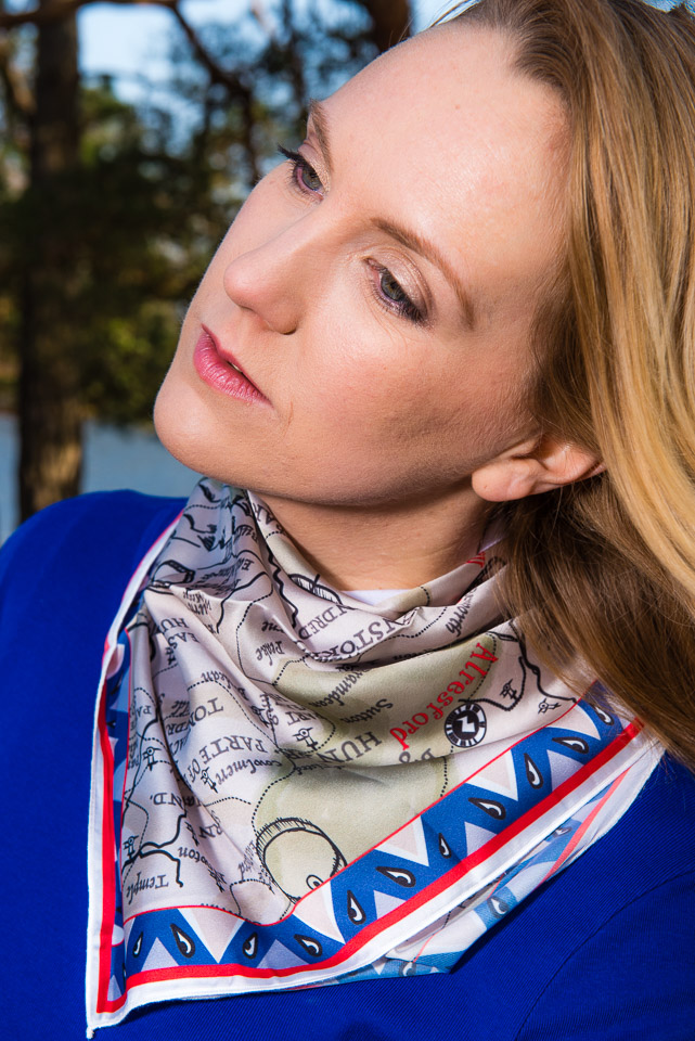
Don’t want to fold it? SplashMaps are “scrunchable”. Just scrunch it up into a ball and chuck it into your pack, or wear it like a scarf to keep the chill out.
Yes, it’s the 21st century and we have the world at our fingertips. There’s an app for everything – including any number of apps for walking and hiking whether you’re an Apple or Android user. Of course there is a huge range of digital tools and apps that you can use – some more basic and some full of features.
Mapping apps that use GPS like Google Maps try to be the answer to everything, but they’re not designed with walkers trying to navigate trails on every type of terrain.
Other apps like Komoot and Viewranger are better suited to walking and hiking, but they’re still digital tools.
Yes Google or a GPS can be helpful for finding your way back on a trail if you’ve gone the wrong way or have got lost. But fabric maps come with all of these things plus more that make them so much better than digital alternatives:
The Ordnance Survey also has an OS Maps app for iOS and Android. The app lets you download and cache map data for the whole of Great Britain meaning that you don’t have to depend on always having a signal to keep on track – but you have to remember to download the map data before heading out up that mountain.
Basic features of many apps are free, but there are also a lot of other features like being able to save offline maps and route planning features which require you to pay for the premium version – often an ongoing subscription and not a one-off fee.
Switching between apps (Strava to OS to Komoot) can be a drag too. Think how much of the outdoors you’re missing as you fiddle!
You could even download an augmented reality app which could help you visualise your location and navigate to your next marker or to a place of safety in an emergency.
But all these apps have one thing in common – they need data and power.
A fabric map is much more robust a digital alternative because they’re tough, waterproof and can withstand all sorts of weather conditions – not just withstanding but actually thriving in them too! A fabric map takes away so many negatives of working with an app on your phone.
Fabric maps are also small enough to carry in your pocket or purse, so if you’re walking somewhere unfamiliar where finding your way is tricky, they can be invaluable because they don’t rely on an internet connection to grab the information required.
It’s also much easier to see the details on a map than on a small screen like a phone or GPS where you’re dealing with a very small screen and glare from the sun
Fabric maps are more durable and will last longer than digital maps because they’re not subject to battery drain or electricity outages. They don’t require a power source, so you’ll never be without directions again! And this could save your life one day in a worst case scenario.
Probably the best feature of a fabric map compared to a phone is the fact that it won’t break if you drop it. At best you scratch the screen of your phone dropping it on a rocky path or trail. At worst, you drop it in a stream or off the edge of a cliff.
These detailed offline fabric maps are perfect for the all-weather, long distance walker and hiker. Our range covers all UK national parks already, and you can have your own map custom made to cover your next trip anywhere in the world. Many of our maps are in fact Ordnance Survey maps printed on highest quality fabric
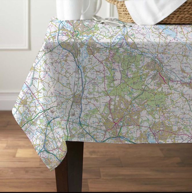
They are also available in 10 different formats including tablecloths, towels and even shower curtains! They make great gifts for friends and family members who love exploring new places!
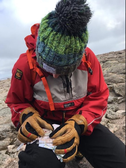
You’ll need a basic understanding of how to navigate using a map and compass if you’re venturing out with a SplashMap, but you should have those skills as a backup anyway, even if your primary navigation tool is an app. If you misjudge the distance or terrain, having the basic navigation skills to get to safety, or the survival skills to stay safe while you await a rescue could save your life one day.
Depending on the destination of your next adventure, you’ll either find the perfect walking map already in our store, or you can create your own. We have Harvey maps and Ordnance Survey maps printed on our fine fabric that won’t rip like a paper map.
