$85


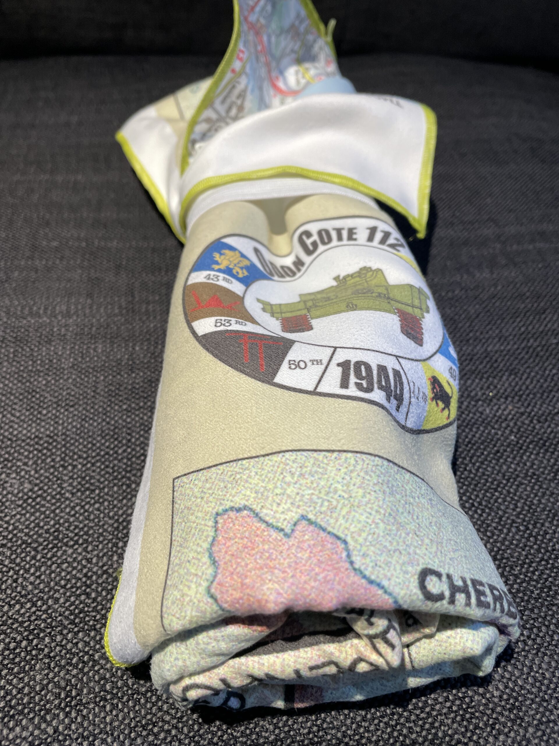
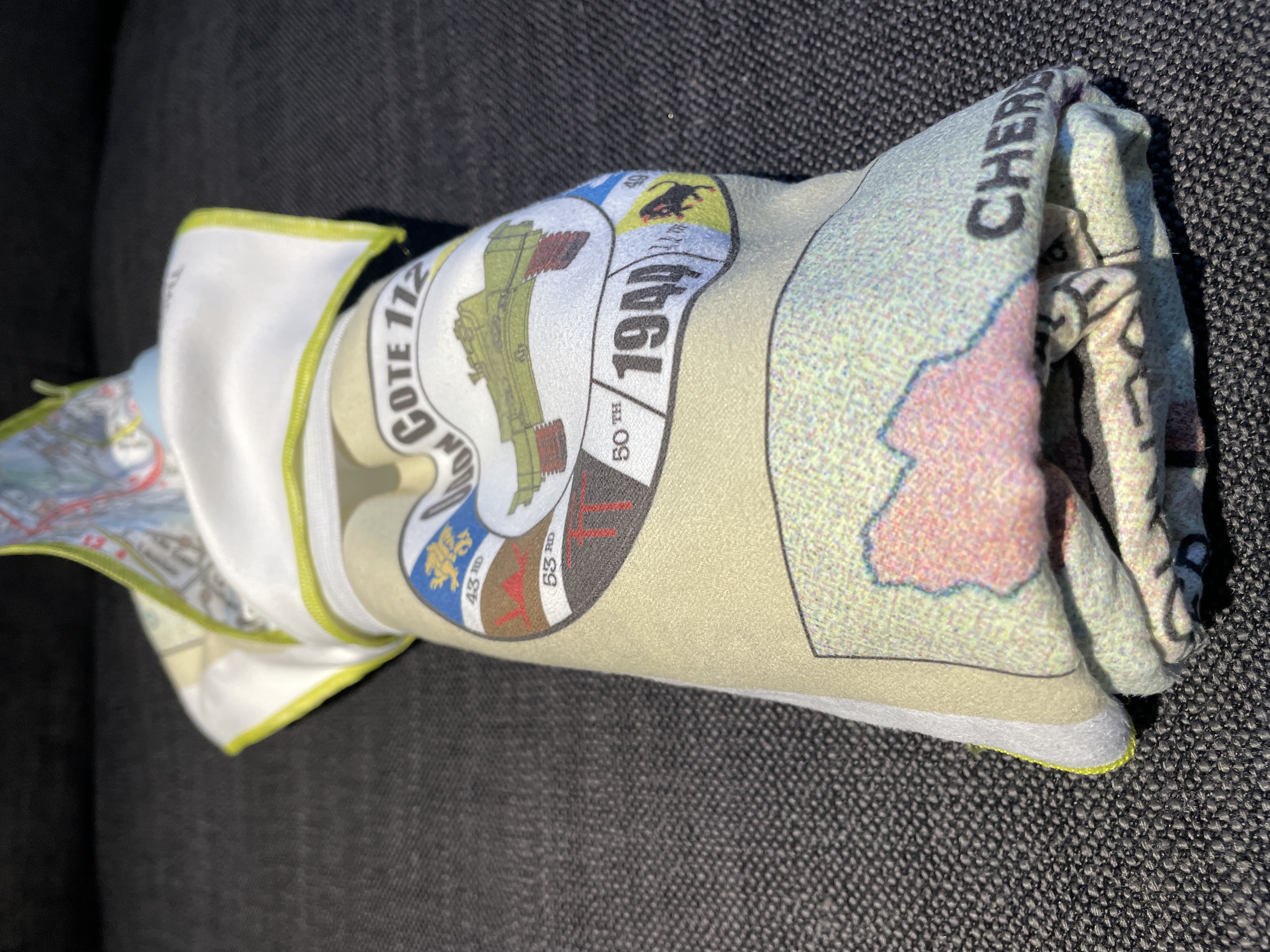
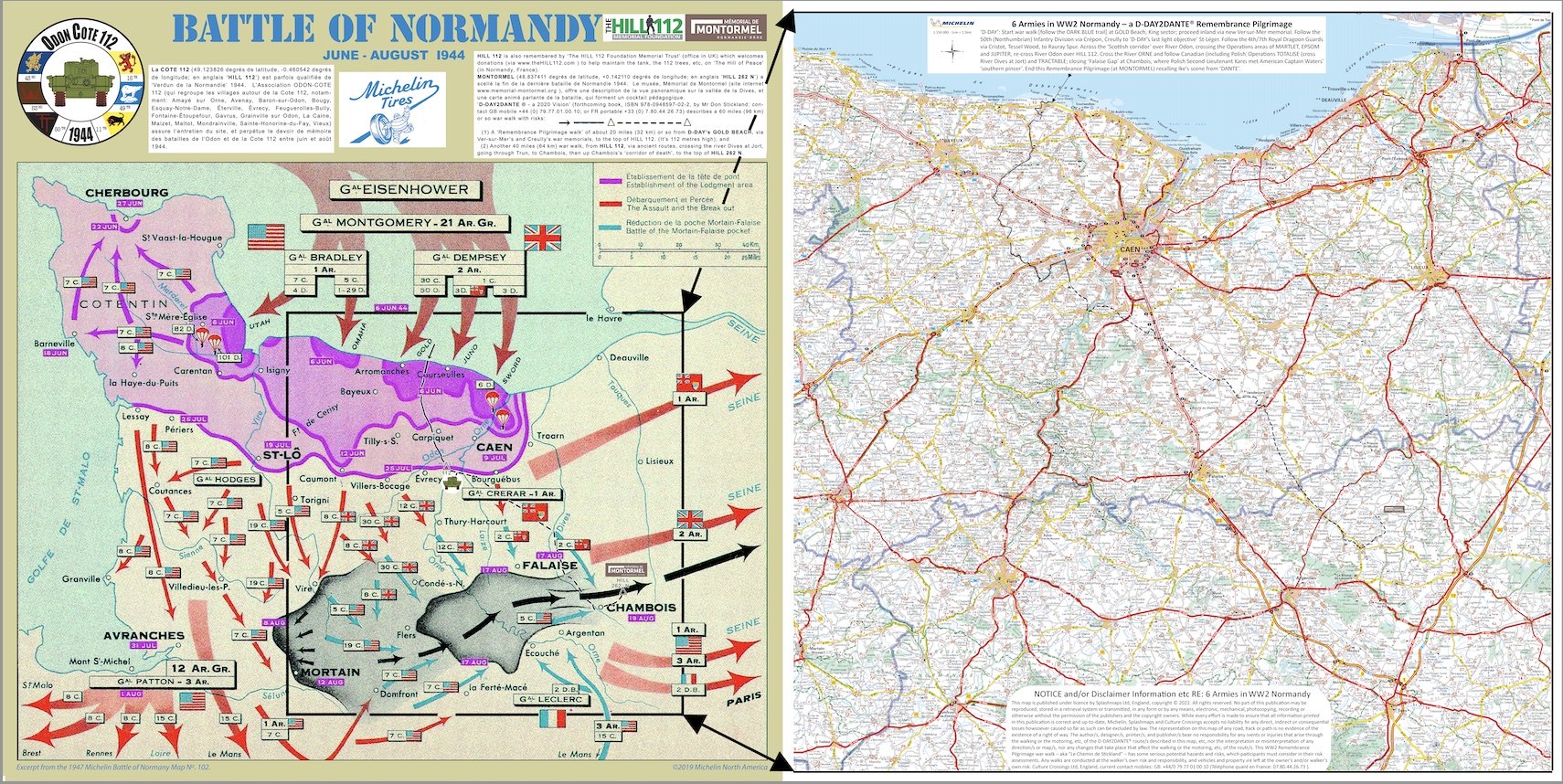
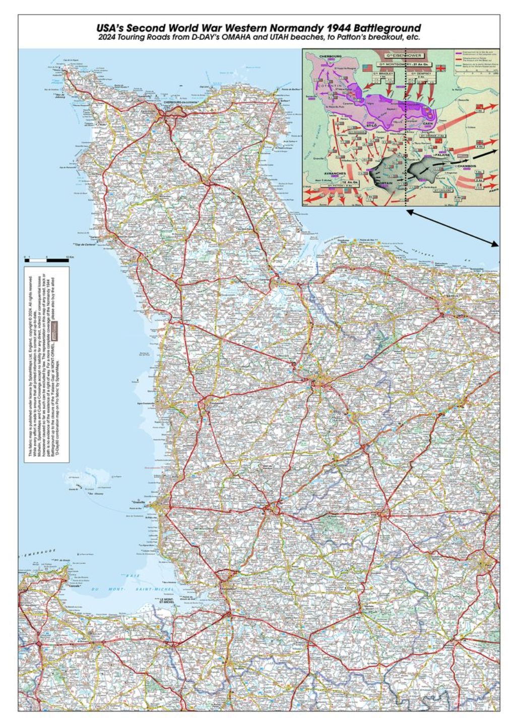
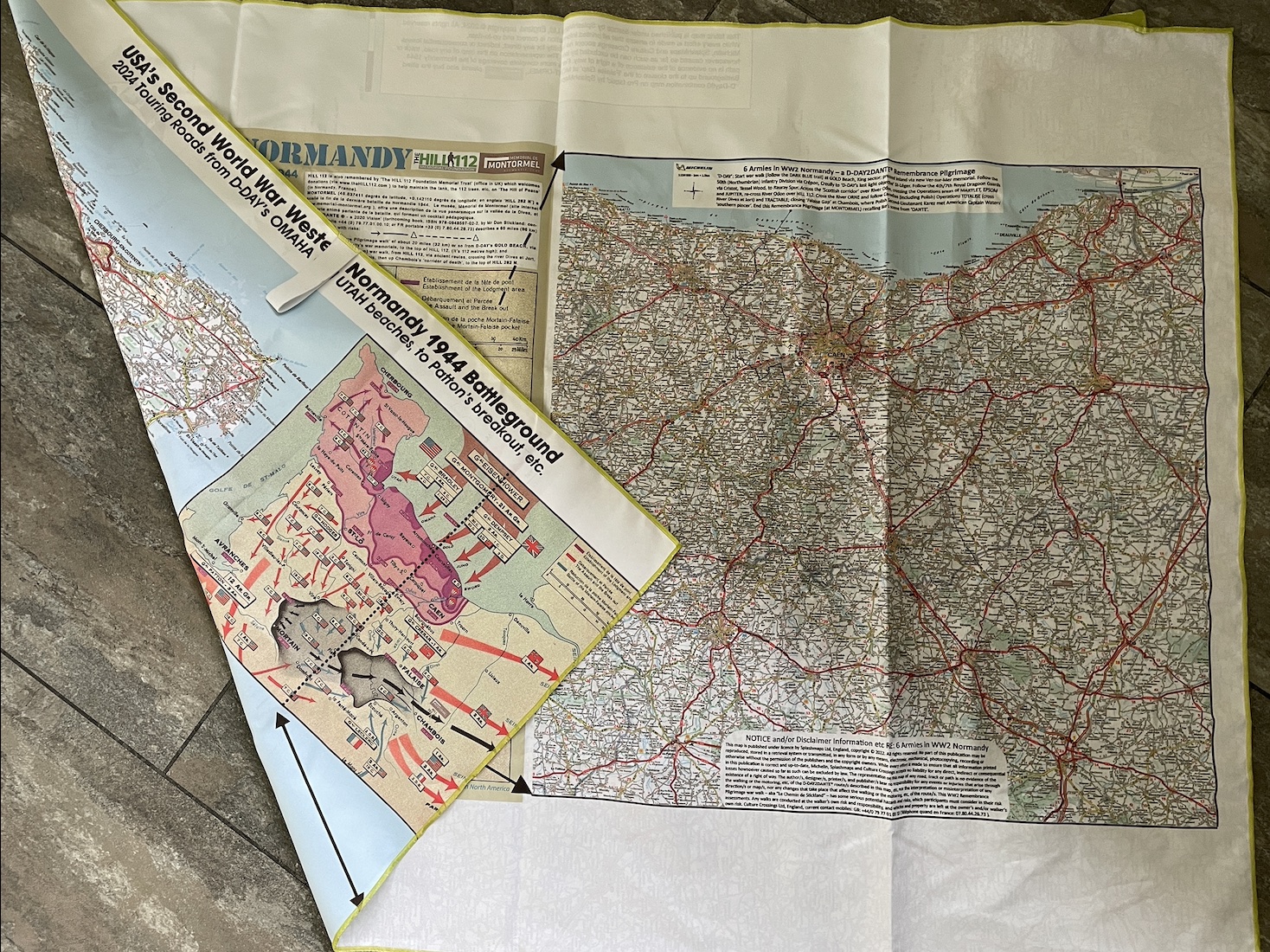
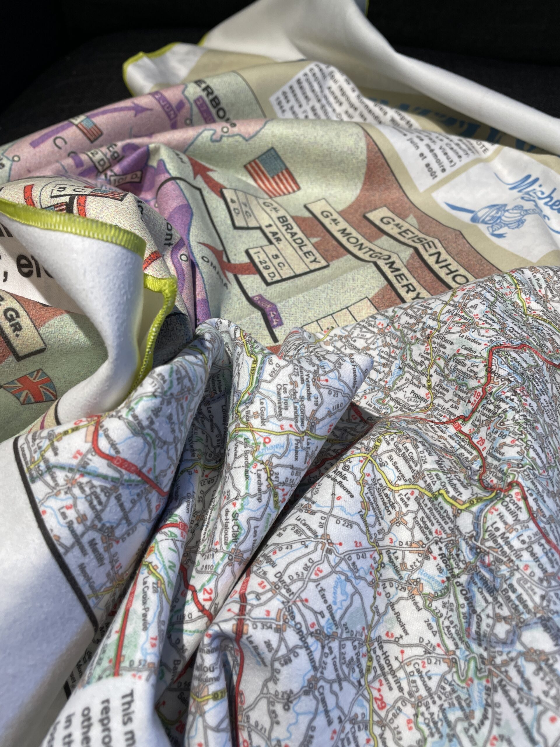
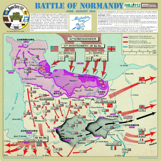
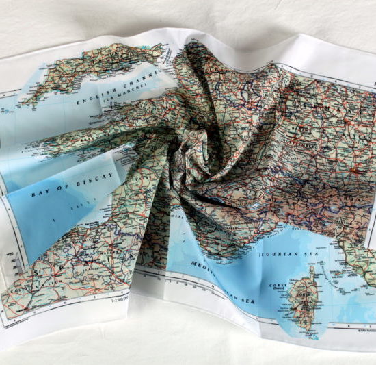
An overview map of the 1944 advances related to a 1:150 000 scale map of modern day Normandy, showing the route of allied troops to Montormel on a rapid drying microfibre towel from SplashMaps. The perfect aid to tourism guides, hikers, cyclists and visitors to the WW2 Normandy landing beaches and beyond, highlighting key strategic positions and the Churchill tank memorial at Hill 112 and the Montormel Museum. NEW: The towel is reversible, focussing on US advances one side, UK and Canadian the other.
2 in stock (can be backordered)
Eighty years after the historic events of World War II, embark on a journey of remembrance with our exclusive D-Day 80th Anniversary Normandy Advance SplashMap. This microfibre hiking towel, perfect for both collectors and adventurers, is meticulously reproduced from historical and contemporary Michelin maps. It’s not just a guide—it’s the ultimate practical companion for your memorial hikes, featuring quick-drying material for convenience on the go. Uniquely, our Battlefield map towel showcases detailed maps on both sides: UK & Canadian advances on one, and US advances on the other.
Why take a SplashMap on a Battlefield visit or tour? Ask the Guild of Battlefield Guides
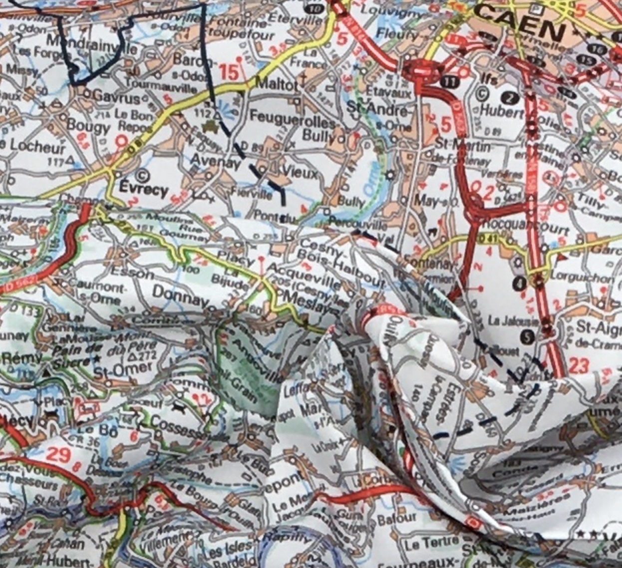
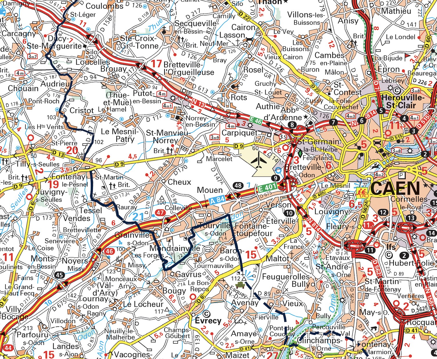
This SplashMaps® Michelin derived Normandy Tourist map on fabric shows the great majority of the good roads in this part of France, and includes four famous French major tourist destinations (in the Department of Calvados) for great individual days out in either Caen (William the Conqueror’s Capital), Bayeux (for the 1066 invasion Tapestry), “aristocratic” and elegant Deauville, or Honfleur.
For the literary minded, there’s coastal Cabourg, which can also be reached by train from Paris, etc. Cabourg is the model for Proust’s fictional town Balbec in his seven-part novel ‘In Search of Lost Time’. Marcel Proust wrote much of his book during summer vacations at Cabourg’s waterfront Grand-Hôtel, recalling the building, its dining room, and the raised esplanade (now called ‘Promenade Marcel Proust’) that runs in front of the hotel, and along the beach for 3.6 km. This Grand-Hôtel continues to operate as a luxury hotel – and Proust’s room (number 414) has been recreated with period furnishing and décor!
For cyclists – and walkers – this map includes some ‘voies vertes’ [green ways], e.g. from Caen to the ferry port of Ouistreham, which joins up with the coastal paths along the D-Day Beaches [see https://www.francevelotourisme.com/destinations/normandie-a-velo etc].
Finally, for enthusiastic map interpreters, this map indicates the varying “tilt” of the land by showing some complete rivers flowing from their sources to the sea. These complete rivers include the Seulles, the Orne, the Dives; and also the complete river Odon, from its source to Caen where it joins the river Orne. The route of “Our Walk D-DAY2DANTE®” crosses these rivers. Also the river Touques flows to the east of the hills at MONTORMEL, from its source in the Perche hills south of Gacé, through Lisieux, and on to the sea ports at Trouville-Deauville.
‘D-DAY’: Start war walk at GOLD Beach, King sector; proceed inland via new Ver-sur-Mer memorial. Follow the 50th (Northumbrian) Infantry Division via Crépon, Creully to ‘D-DAY’s last light objective’ St-Léger. Follow 4th/7th Royal Dragoon Guards via Cristot, Tessel Wood, to Rauray Spur. Across the ‘Scottish corridor’ over River Odon, onto Operations areas of MARTLET, EPSOM and JUPITER, re-cross River Odon over HILL 112. Cross the River ORNE and follow Canadian (including Polish) Operations TOTALISE (cross River Dives at Jort) and TRACTABLE; closing ‘Falaise Gap’ at Chambois, where Polish Second-Lieutenant Karez met American Captain Waters’ ‘southern pincer’. End Remembrance Pilgrimage (at MONTORMEL) recalling USA’s Ike’s scene from ‘DANTE’.
We believe these sites (HILL 112 and MONTORMEL) deserve recognition by UNESCO on their World Heritage List. That’s why the D-DAY2DANTE ® war walk was developed by Culture Crossings Ltd., to link each of them to GOLD Beach. They were focal points in the Battle of Normandy, thus leading to the foundation of the United Nations (UN) by the victors of WW2.
“The United Nations have inflicted upon the Germans great defeats, in open battle, man-to-man.” US General Dwight Eisenhower’s letter to troops before D-Day.
An overview map for the whole walk and the context of the battles are found in our Battle of Normandy via Hill 112 product.
You can upgrade your map to a fabulous Microfibre towel featuring both maps on one quick-drying product!
Original Escape and Evasion maps of the period were often printed on fabric. They supported covert operations and resistance behind enemy lines. Escape and Evasion maps remain crucial in the liberation of airmen and in paving the way for successful campaigns today. Battlefield guides now use them for relaying the important facts of the Liberation for future generations.
SplashMaps’ Battle Maps cover the major conflicts of WW1 and WW2 and are available on our legendary Pro weatherproof fabrics. They can be upgraded to a larger size. Uniquely this map is designed as a towel to support those that want to follow the trails themselves.
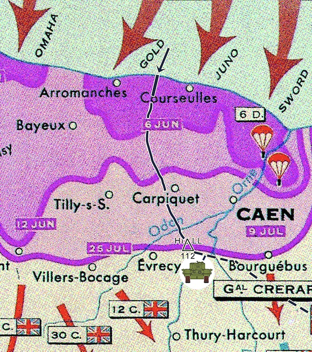
Boldly marked advancements of the British and USA commands from sea and aerial landings to the land battles. Landing Beaches Juno, Sword, Gold, Omaha. Major liberations of Caen, Courseuulles and Arromanches. German advances at Mortain and Falaise and the eventual allied advancements towards Paris, the Seine and Belgium.
Scale = 1:150 000
| Weight | 0.058 kg |
|---|---|
| Dimensions | 73 × 73 cm |
| Map Scale | 1:150 000 |
Only logged in customers who have purchased this product may leave a review.
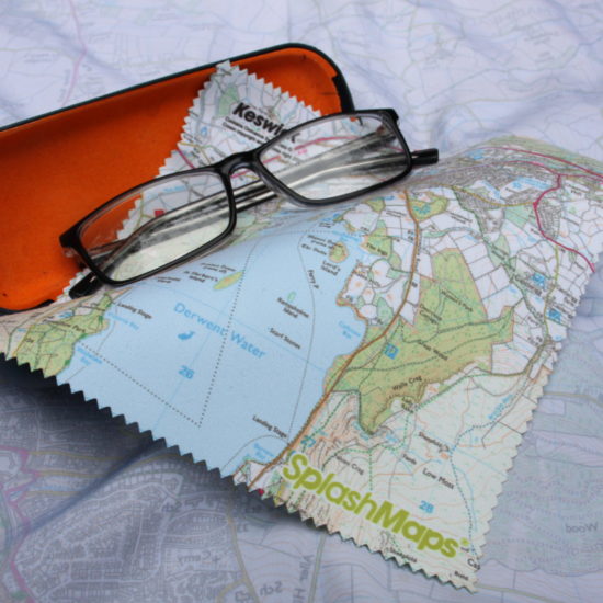
Washable, wearable, all-weather worldwide Maps. Experience true confidence in your adventure.

| Cookie | Duration | Description |
|---|---|---|
| cookielawinfo-checkbox-analytics | 11 months | This cookie is set by GDPR Cookie Consent plugin. The cookie is used to store the user consent for the cookies in the category "Analytics". |
| cookielawinfo-checkbox-functional | 11 months | The cookie is set by GDPR cookie consent to record the user consent for the cookies in the category "Functional". |
| cookielawinfo-checkbox-necessary | 11 months | This cookie is set by GDPR Cookie Consent plugin. The cookies is used to store the user consent for the cookies in the category "Necessary". |
| cookielawinfo-checkbox-others | 11 months | This cookie is set by GDPR Cookie Consent plugin. The cookie is used to store the user consent for the cookies in the category "Other. |
| cookielawinfo-checkbox-performance | 11 months | This cookie is set by GDPR Cookie Consent plugin. The cookie is used to store the user consent for the cookies in the category "Performance". |
| viewed_cookie_policy | 11 months | The cookie is set by the GDPR Cookie Consent plugin and is used to store whether or not user has consented to the use of cookies. It does not store any personal data. |

Reviews
There are no reviews yet.