Description
Perfect for guides to the Normandy Landing Beaches
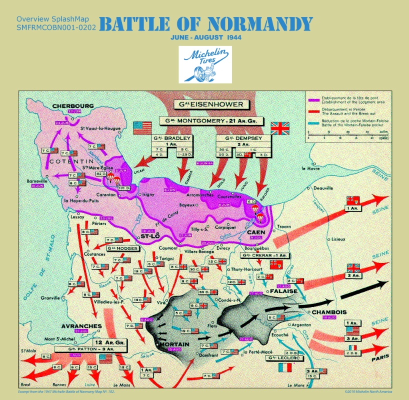
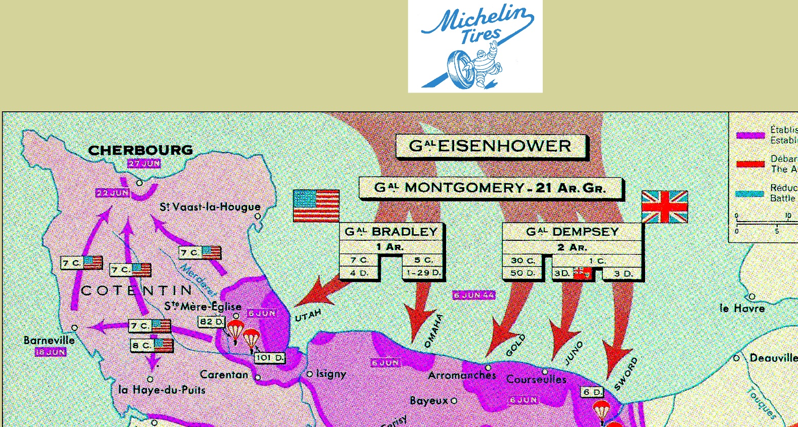
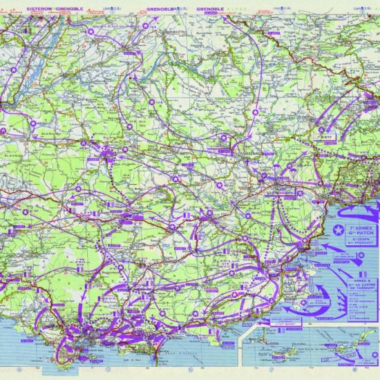
This Battle of Normandy Overview Michelin SplashMap commemorates the World War Two liberation of Europe. This bold extract from our Battle of Normandy Michelin SplashMap has been defined together with an expert historian guide, Bob Shaw, and with the cartographic teams at Michelin and SplashMaps to create the ideal overview of the landings, battles and troop movements during the Summer of 1944.
Discovering the Normandy Landings Beaches: An Essential Map for History Buffs
Step back in time and embark on a journey to the historic Normandy Landings Beaches. For history buffs and adventure seekers alike, this essential map will guide you through the monumental sites that forever changed the course of World War II. Immerse yourself in the stories of valor, sacrifice, and liberation as you explore the very beaches where Allied forces made their courageous landing on D-Day. This meticulously designed map not only provides precise directions, but also offers a glimpse into the past, with detailed descriptions of each location and its significance. Whether you’re a seasoned historian or simply curious about the events that shaped our world, this map is your key to unlocking the untold stories of the Normandy Landings Beaches. Get ready to walk in the footsteps of heroes and witness history come alive before your eyes.
Escape and Evasion Maps
Original Escape and Evasion maps of the period were often printed on fabric to support covert operations and resistance behind enemy lines. Escape and Evasion maps remain crucial in the liberation of airmen and in paving the way for successful campaigns today. Now they find their use in relaying the important facts of the Liberation for future generations.
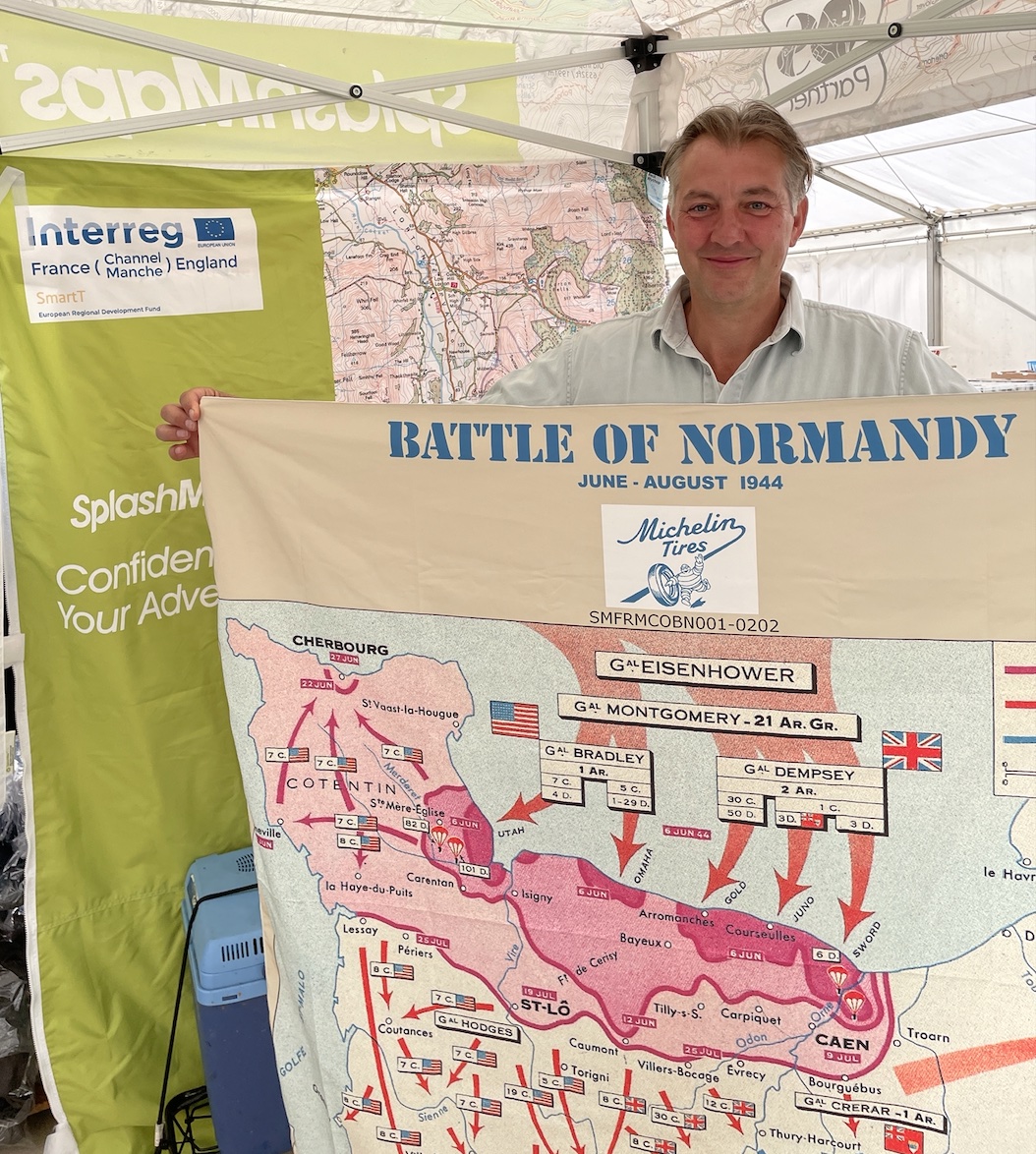
SplashMaps’ Pro weatherproof fabric
The Michelin SplashMaps use SplashMaps’ Pro weatherproof fabric to survive everything. They’ll guide you to the key locations and live as a memento of key events from your and the world’s history. They double-up as perfect bandanas!
Key content
Boldly marked advancements of the British and USA commands from sea and aerial landings to the land battles. Landing Beaches Juno, Sword, Gold, Omaha, Utah. Major liberations of Cherbourg, Caen, St-Lo, Cotentin, Courseuiles, Arromanches, Isigny, St Mere-Eglise, la Haye-du-Puits, Avranches, Mont St-Michel. German advances at Mortain and Falaise and the eventual advancements to Paris, the Seine, Le Mans, The Loire Valley, St Malo, Brest, Rennes and the companies involved in each.
Size
28″ x 28″
73 x 73 cm
Only logged in customers who have purchased this product may leave a review.


Reviews
There are no reviews yet.