This week our Make-a-Map personalised map service took-on its greatest test. Can our maps be made to explore anywhere? Could we really make dedicated maps for 9 of the countries’ top explorers’ expeditions in the space of half an hour? Our friends at the RGS-IBG threw down the gauntlet and we had a go…
Each maps I made would be hand delivered to expedition leaders at the Royal Geographical Societies (RGS-IBG) annual Explore event at the SplashMaps stand. The RGS-IBG got to work making our lives as hard as possible. They mailed-out to their closest circle of intrepid explorers with the broadest international interests. 9 challenges returned and here’s what we made…

When I lived in Africa Mozambique was a war-torn no-go area. Relatively peaceful now the north of the country is an untouched wilderness. Samuel Jones’ visits over the past 2 years have been to the most remote north. From the school of biological sciences at the Royal Holloway, he scaled 3 mountains to monitor the unique biodiversity of the area . Making his map was relatively easy given the broad coordinates. I could then use the preview function to assure that the major peaks of the area were all included. Job done.
Will Close-Ash, an international mountain leader from expedition company, Mountain Energy, wanted a map of the Cheviot Hills in the Northumberland National Park. As a UK map this one popped out of our system in seconds as a beautiful Ordnance Survey 1:25k Map. May be a challenge on foot, but no challenge for our map maker!


James Dyer recently cycled the route Hanibal took. The pinnacle of the challenge involved the Greek town, Thermopolye. However, he didn’t want the town in the middle, but asked me to offset to the north in order to capture the challenging terrain on his approach. Again this was super simple to arrange thanks to the preview function.

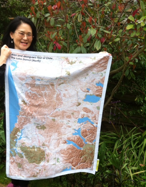
Not everyone is this specific, but for Rob and Harriet Fraser their project for the coming year is literally centred on a tree in the middle of the Lake District. Over the year they will be walking, camping and running events in Cumbria, working around the county as if it is a clockface with the hands radiating out from this tree. They’ll be monitoring the biodiversity and environmental impacts in this delicate environment.

Every trip to the Antarctic needs a stop at Port Lockroy, so when Dr Claire Grogan told me she’s headed for the Weddell Sea in Antarctica this December, she was amazed when I told her “we have that one in stock”. Thanks to our customer the United Kingdom Antarctic Heritage Trust a consignment of hundreds of British Antarctic Survey SplashMaps Toobs (versatile headwear) are already part way through their 2 month voyage to the visitor centre. Luckly I’ve held back samples. I’m sure Claire will love the Gentoo penguin design on the reverse too!
Seriu Jiduc is the Founder of the Karakoram Anomaly Project with the Climate Bonds Initiative. He’s using height models combined with high-resolution satellite imagery to observe the impact of environmental changes on this gigantic glacier. Our map centres on this glacial valley in the remote Pakistani Himalaya.

Sam McConnell is an expedition leader who wanted a map titled “Nambia – Bones of the Earth” for a map that traverses the Skelleton coast. He’s starting out from the wreck of the good ship Winston and heading inland across one of the most formidable landscapes know to man. “It’s sounds brilliant, I’m really looking forward to seeing it,” he said.of his SplashMap.

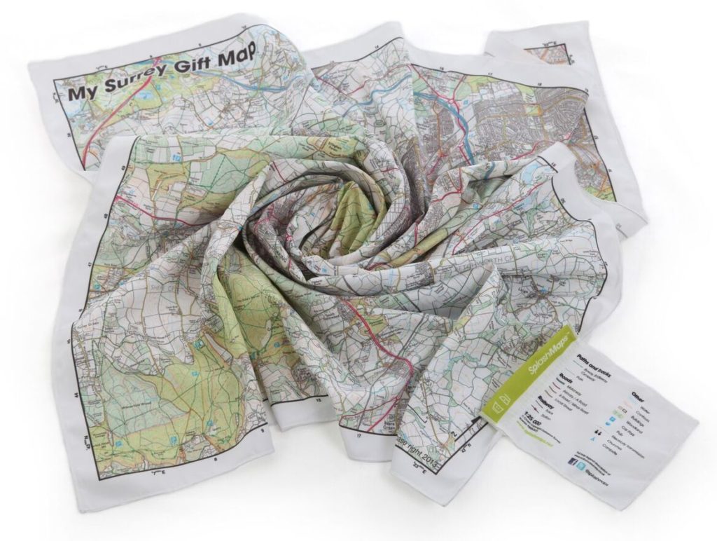
Even the best of the explorers need down-time, so when Duncan Milligan of Tour de Force – chair of next week’s vehicle dependent expedition panel at Explore – contacted us he asked, “can I get a map of my local area,”. Sure thing Duncan, anywhere you like, that’s what it’s all about! One beautiful Ordnance Survey 1:25k print of your patch coming up. Something more bespoke for those long distances to come later…

Paul Rose is a busy man right now as his popular series on Lakeland walking hits prime time on BBC2. For some people it’s easy to guess what they’re after. Know anyone who loves a place that much? I’m so looking forward to meeting him next weekend at Explore.
So that’s 9 maps; each location was found using the map search tool on our Make-a-Map page. Each were adjusted to include exactly the right features on the ground by simply slipping the map around. Each were checked using our preview button using exactly the same web site that thousands of customers use.
The process can take less then a minute – the longest stage is always choosing a title to personalise it! Behind these scenes there’s an awesome and unique geographical service network, the result of 6 years of investment, plus professional and volunteer cartographers and surveyors that make the magic work. And as we know, SplashMaps are the only company that offer explore anywhere maps, and certainly the only ones to make on expedition proof fabric as a standard.