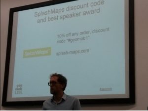
This weeks GeoMob in London generated the hottest Geo News and a multi-million opportunity! This regular bi-monthly gathering is clearly attracting some fascinating subject matter and has become the go-to place for those with big Geo-problems that need a bright solution. SplashMaps is a co-sponsor and helps with the free beers and the much coveted prize for best speaker.
A genuine plethora of Geo “did you knows?” were in full flow and the 4 speakers covered ground from the rating of estate agents using GIS to the concepts of Earth Observation 2.0. To top it all a BIG potential contract emerged from the Land Registry themselves. After all, every good Geomobber likes a challenge!

Geo News:
Gareth Morgan, CEO of Terrabotics
The start-up mushroomed in a Texan accelerator programme; from a lone PHD in UCL London (our venue for the evening) to 8 people in the space of a year! The team combine their knowledge in artificial intelligence, photogrammetry, change detection and data collection to apply to the natural resources and energy sectors.
Gavin explained that traditional earth observation businesses were being categorised as “the Raster men” so they set about exploiting the slow speed of current incumbents in embracing modern data crunching and analytical tools. “We’re pursuing EO2.0” he added, working largely on bespoke projects but also turning out their own geo-analytical tools to “de-risk” high investment projects like well sinking in the oil industry.
The team combine skills and through clever mastery of EO tools can transform their drone captured imagery into a digital terrain model (heights of the land) to mimic a much more expensive lidar (laser technology) sweep of the terrain.
Speed of getting the answers is crucial for the decision makers in this sector. As well as the change detection algorithms they use the OpenCage geocoder to help with change maps. @tbotics
Next-up! Ever wanted some stats to help you choose between Estate Agents? Don’t be fooled by winning smiles, slick haircuts and the promise of flowers when you move. Now there’s a way to find out who really cuts the mustard thanks to Geographic information.
-Who gives the most accurate valuations (vs the actual end sale price)
-Who sells the houses quickest
-Who has the most properties on their books
The business makes 0.25% on the sale price of the house from the successful agent, averaging £1200 per sale. They’ve now signed-up 4000 agents and there are thousands more to engage!

I used to mountain bike with Denise McKenzie‘s husband (it’s all happening in Hampshire!). She’s now the Executive Director, Communications & Outreach for the standards body, OGC (Open Geospatial Consortium) and he’s at one of my favourite business, Snowflake Software. I’ve worked a lot with standards bodies and it really is a very very dry subject. Bringing it to life takes some imagination and some photogenic kids! Denise exploited both by relating the importance of winning the “Standards War” as the tipping point for internet connected devices was drawing near. How irritating is it to have Android incompatible with all Apple products? Imagine that across ALL the things in life you really find useful. Like fridges and toasters?
She’s started early with her kids too! Her 7 year old son was seen creating his own Minecraft game with a raspberry pi. and is clearly on the way to developing the standards for the fabled Internet of Things.
Why are things so disjointed? Of course there are commercial interests which still lean toward proprietary systems, but there’s also a sense of standards moving way slower than the technology they serve. Denise gave an example as the sensor standards of the OGC. When these were derived the use case was on Earth Observation sensors. Nowadays sensors are everywhere, yet the standards have not changed significantly. The result? All the standards have become siloed making it hard to interoperate across the various platforms.
How is the Open Geospatial Consortium helping? For a start it’s getting more “open” and a touch more agile. All their projects are available via github to get exposure to the community at an early stage and anyone is welcome to their meetings. This, says Denise, means that adaptations of the standards happen “when the need is discovered rather than developed in a closed community over a period of years.”
She closed with a plea to the Geo-experts in the room that we all try and contribute so that the diverse range of applications for Geographic Services are considered. Perhaps the silos become the only casualty in the Standards Wars?
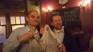
Andrew Trigg used to be my own boss, and is now Head of Data at the Land Registry. Even better, he’s now the owner of one of our SplashMaps thanks to the delivery the perfect presentation. Hang-on! Perfect? He over-ran, left a prop on the train and even had his session delayed to the end of the evening. So how did he win? Could it be the sweet scent of cash?
Andrew pointed out that the Land Registry is really an insurance company! It indemnifies a property owner against the potential for error in their registration of his/her titles.
The interesting stat is that only 83% of the property in the country is registered and in fact compulsory registry has been very slowly building over a period of 40 years. In Europe, by comparison, many countries are at 100% thanks to their Cadastral systems.
Another interesting fact was that the LR own more maps even than the Ordnance Survey. In fact it’s the biggest repository of maps in the country as historic editions of OS’s mapping have to be stored to assess the original context when the land was first registred. The LR’s Inspire product has placed much of the the digital stuff in the public domain as used last Geomob for the topical Private Eye London property map.
However, despite these great leaps in systems and openness, so much is still based upon interpreting paper drawings that it generates a significant headache for the registry.
So Andrew thew down a #Geomob Challenge! Seventeen million titles are in paper or raster form. Getting these digitised and databased would costs a 9 figure number to do. The challenge is “to contribute your ideas to getting this done more efficiently”. With such large numbers involved this is a lucrative challenge to go before the mob.
 But Andrew is looking for fruit from the lower branches. The easy wins to start eating into this elephantine problem.
Got a solution? Even part of a solution, then simply pop him the following tweet “Hi @adtrigg I can fix the @LandRegistry #digitisation problem Let’s talk Turkey”. Clearly we’d seen the hottest Geo News and a multi-million opportunity!
More Geo News
Not only was it the best place to learn about the latest in Geo it was also time to pick up tickets to Foss4G in Southampton (Steven Feldman offering great rates for geomobsters)
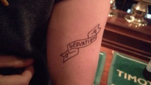
Then to the Jeremy Bentham pub to compare Geo-tattoos! Now that’s dedication!
