 Do you know what we mean by an ‘interactive map’? At SplashMaps We’re having trouble distilling the idea of a map that you can scan with your phone to reveal more fabulous information on that area than just its geographical features.
For example, our (currently!) very poorly named ‘Harry’s Hampshire Interactive Map’ is a unique historically inspired map. On one hand, it’s a beautiful map; printed on satin in the legendary style of 16th Century cartographer, John Speed. On the other, it’s a high-tech marvel, full of secrets.
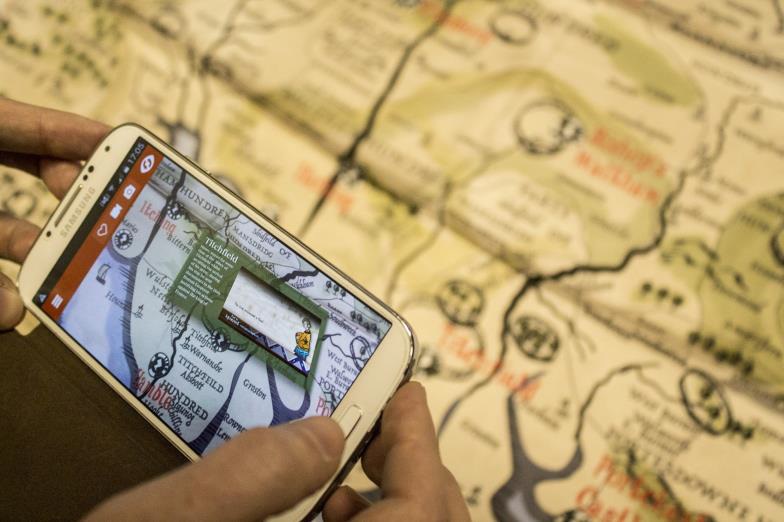
Augmented reality is used to embed hidden historical information (revealed only by scanning it with your phone) including animations and stories related to Hampshire’s role in the build up to and aftermath of the Battle of Agincourt. The information can even be updated as it links to the Road to Agincourt website (wizardry; told you!).
Road to Agincourt commissioned us to create this map working with fellow Eastleigh Tec Hub members Blue Donut Studios and funded by the Heritage Lottery Fund
If this all sounds exciting but a little surreal watch this video of how it works and then please, please come up with a better name for this amazing map!
