Team SplashMaps donned our Adventure Race Maps for the Bear Grylls Survival race. It was clear, from the start, that no else dared bring out their GPSs or, worst still, old fashioned paper folding maps and dodgy laminated sheets.
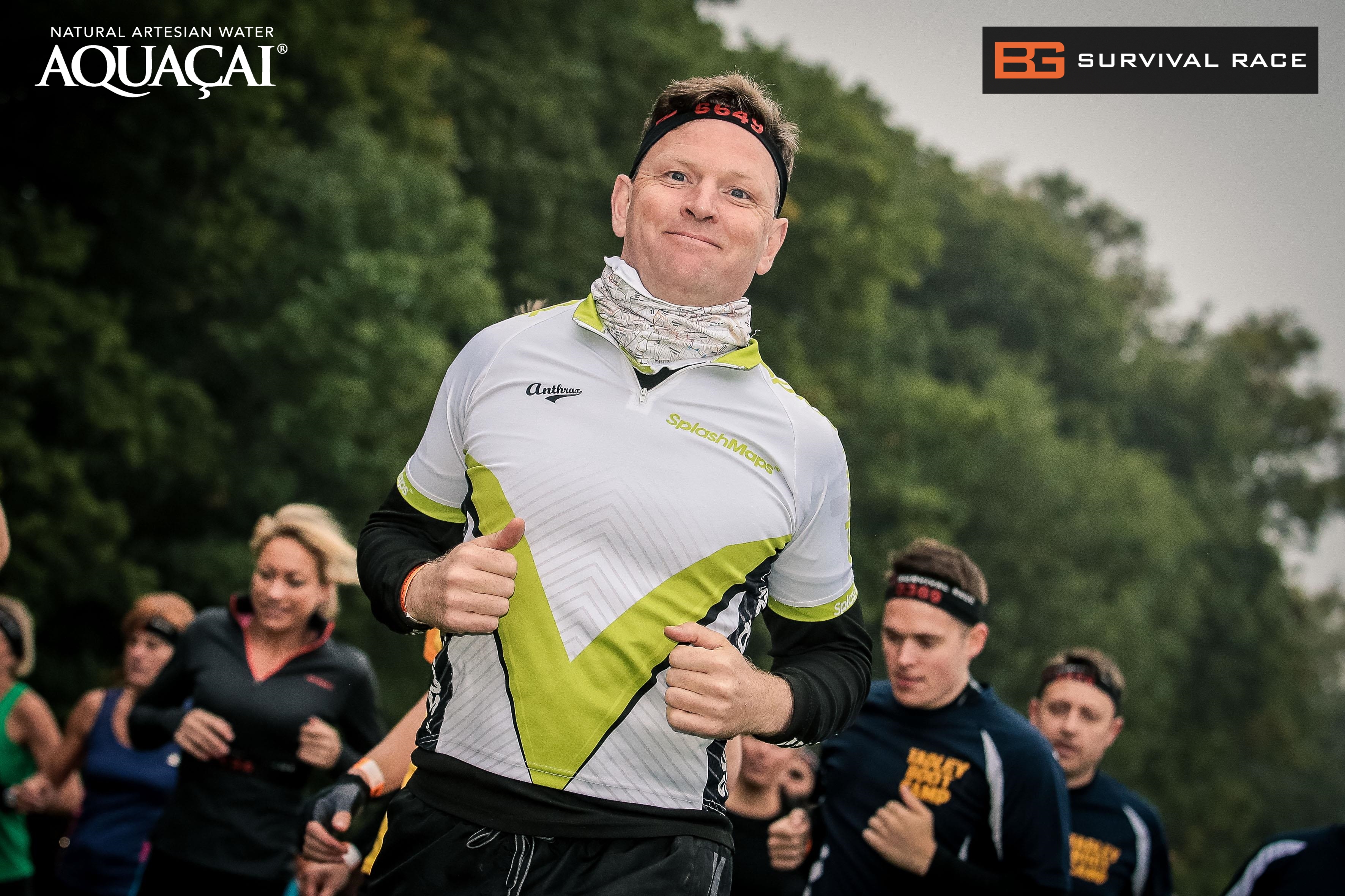
“I normally run Triathlons…” (Ed: slowly!), “But this took me back to my days with the Territorials, training for my security posting in Iraq,” said Mike Walker. “It was tough and tested every muscle”.

Mike fashioned our latest SplashMaps Stretch neck warmer of the Dartmoor National Park.
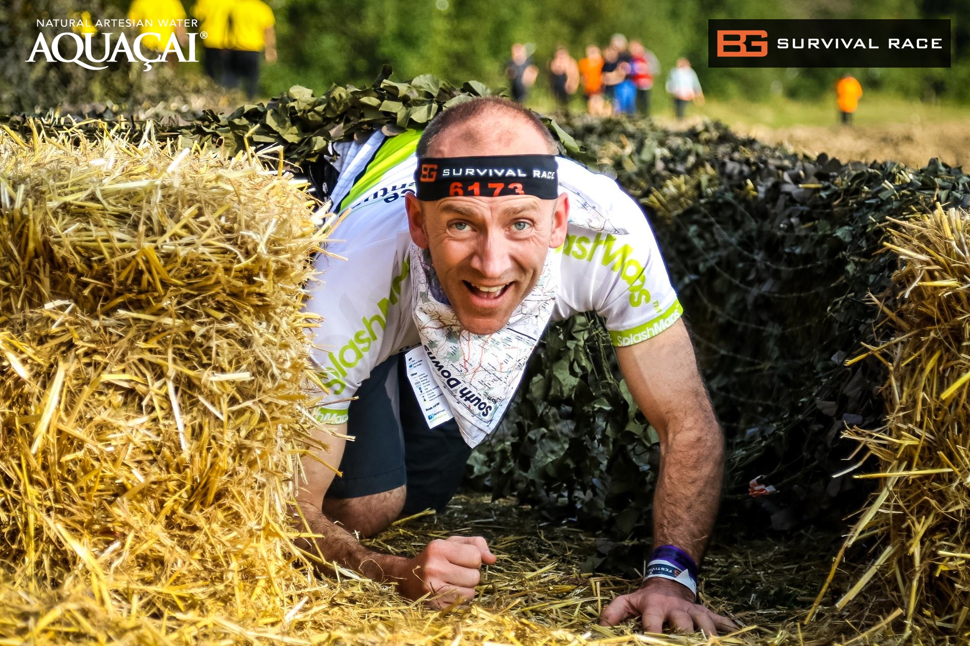
John was next up, he tested our traditional South Downs series of maps tied around the neck. “The map survived everything, but could do with a wash” he said.
Finally, and completing the team’s 20km, David said “This is the toughest test for me and the personalised map! SplashMaps are surely combat ready!”
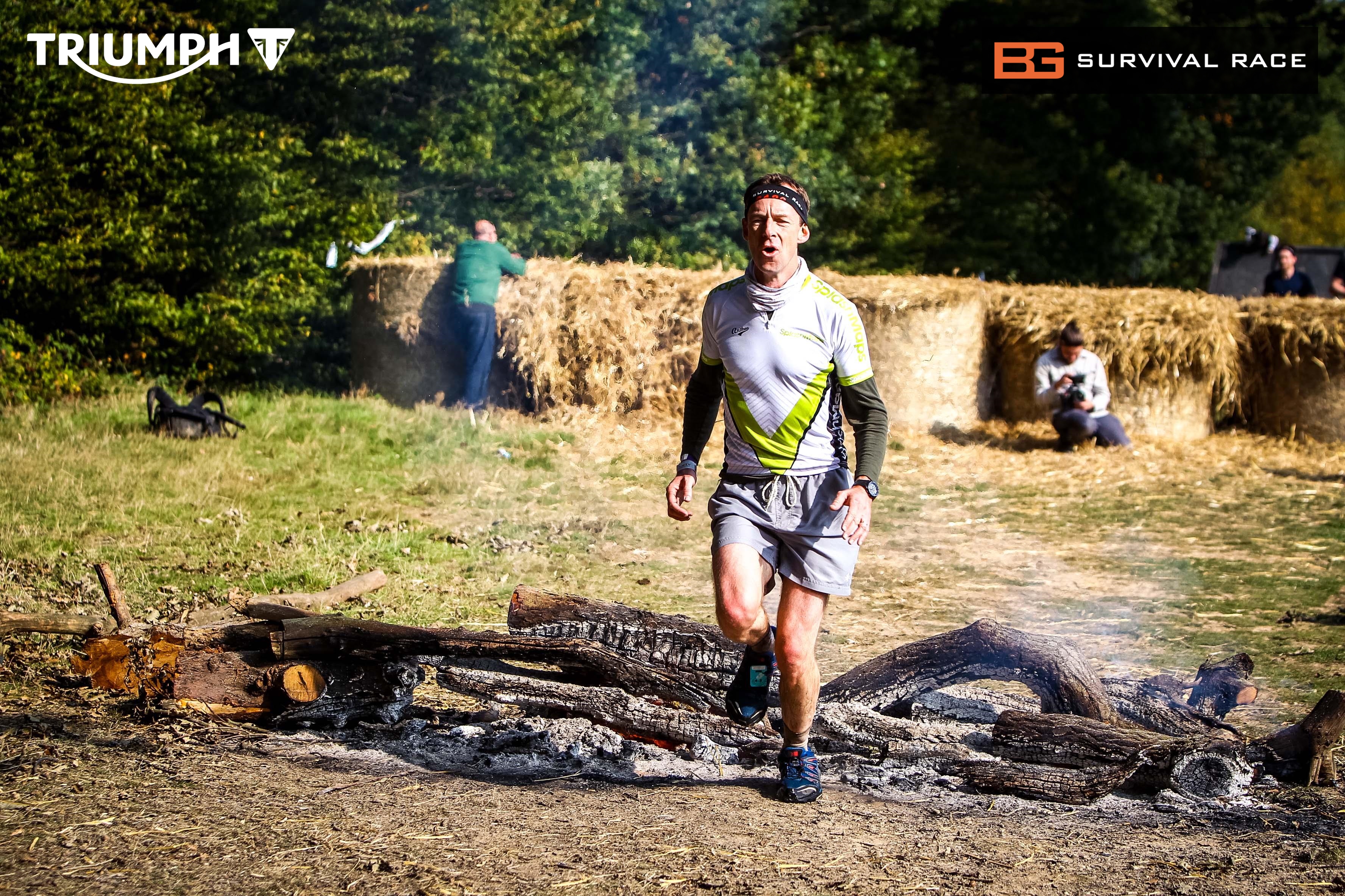
Overall 3 Adventure Race Maps made it through mud, sweat and the occasional pose across 80 military style obstacles. Certainly wherever we could go and whatever the conditions, the maps made it too. I got irritated by the free sweatband which just had to go. The Map, by contrast, regulated the heat loss around the neck, but thankfully was never needed as a bandage or tourniquet.
Our thanks to AWOL for the photos! Great job guys.
